Menmuir: Difference between revisions
Created page with "{{Infobox town |name=Menmuir |county=Angus |picture=Kirkton of Menmuir.jpg |picture caption=Kirkton of Menmuir |population= |census year=approx. 250 |os grid ref=NO532644 |lat..." |
m clean up, typos fixed: Bronze age → Bronze Age |
||
| (One intermediate revision by one other user not shown) | |||
| Line 18: | Line 18: | ||
==History== | ==History== | ||
Neolithic cup and ring marked stones have been found in the area. Bronze | Neolithic cup and ring marked stones have been found in the area. Bronze Age archaeology has been found nearby, with a short cist burial found a mile to the south-east of the village, containing bones and a flint spearhead, and a bronze axehead found nearby.<ref>Jervise (1953); Jervise (1957); Coles (1971)</ref> The Brown [[Caterthun]] and the White Caterthun, hillforts dating from the Iron Age, can also be seen nearby. | ||
A number of Pictish symbol stones have been found in Menmuir, including a cross-slab and a sculptured stone found in the kirkyard around 1844 when an old wall was demolished,<ref>Allen and Anderson (1903); Cron (1843)</ref> three fragments, found in the grounds of the village Manse in 1943,<ref>Stevenson (1958)</ref> and another class III fragment reported in 1986.<ref>Atkinson and Watson (1987)</ref> These point to Menmuir having been a centre of some ecclesiastical importance in the early Mediæval period. | A number of Pictish symbol stones have been found in Menmuir, including a cross-slab and a sculptured stone found in the kirkyard around 1844 when an old wall was demolished,<ref>Allen and Anderson (1903); Cron (1843)</ref> three fragments, found in the grounds of the village Manse in 1943,<ref>Stevenson (1958)</ref> and another class III fragment reported in 1986.<ref>Atkinson and Watson (1987)</ref> These point to Menmuir having been a centre of some ecclesiastical importance in the early Mediæval period. | ||
| Line 29: | Line 29: | ||
The rare surname Menmuir seems to originate from this parish. | The rare surname Menmuir seems to originate from this parish. | ||
[[File:Menmuir Village Hall - geograph.org.uk - 1008753.jpg|right|thumb|200px|Menmuir Village Hall]] | |||
==Outside links== | ==Outside links== | ||
{{commons}} | |||
*[http://www.menmuir.org.uk/ Menmuir Community] | *[http://www.menmuir.org.uk/ Menmuir Community] | ||
*[http://www.angusglens.co.uk/ Angus Glens] | *[http://www.angusglens.co.uk/ Angus Glens] | ||
Latest revision as of 17:41, 29 January 2016
| Menmuir | |
| Angus | |
|---|---|
 Kirkton of Menmuir | |
| Location | |
| Grid reference: | NO532644 |
| Location: | 56°46’8"N, 2°46’2"W |
| Data | |
| Post town: | Brechin |
| Postcode: | DD9 |
| Dialling code: | 01356 |
| Local Government | |
| Council: | Angus |
| Parliamentary constituency: |
Angus |
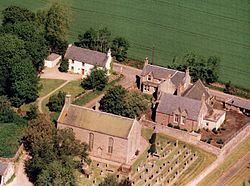
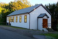
Menmuir is a parish in Angus. Kirkton of Menmuir consists of only three houses (The old Schoolhouse, The Manse, The old Inn) referred to locally as "twa hooses and another yin" but around 250 people live in the area and the community hall is well used.
History
Neolithic cup and ring marked stones have been found in the area. Bronze Age archaeology has been found nearby, with a short cist burial found a mile to the south-east of the village, containing bones and a flint spearhead, and a bronze axehead found nearby.[1] The Brown Caterthun and the White Caterthun, hillforts dating from the Iron Age, can also be seen nearby.
A number of Pictish symbol stones have been found in Menmuir, including a cross-slab and a sculptured stone found in the kirkyard around 1844 when an old wall was demolished,[2] three fragments, found in the grounds of the village Manse in 1943,[3] and another class III fragment reported in 1986.[4] These point to Menmuir having been a centre of some ecclesiastical importance in the early Mediæval period.
A royal palace is supposed to have existed in Menmuir in the reign of Alexander III, a little to the south-west of where the church now stands. However, no remains of it have been found.[5]
Geography
Menmuir straddles the boundary of the fertile coastal land and the start of the Grampian Mountains.
The rare surname Menmuir seems to originate from this parish.

Outside links
| ("Wikimedia Commons" has material about Menmuir) |
References
- Allen, J.R.; Anderson, J. (1903 (1993 facsimile)), The early Christian monuments of Scotland, Balgavies, Angus: Pinkfoot press
- Coles, J.A. (1968). "Scottish Early Bronze Age Metalwork". Proceedings of the Society of Antiquaries of Scotland 101: 1–110. http://ads.ahds.ac.uk/catalogue/adsdata/PSAS_2002/pdf/vol_101/101_001_110.pdf. Retrieved 2009-12-04.
- Cron, W (1843), "Parish of Menmuir", New Statistical Account of Scotland: pp. 656–658, http://books.google.co.uk/books?id=He81AAAAMAAJ&pg=PA656, retrieved 2009-12-04
- Jervise, A (1853), The history and traditions of the land of the Lindsays in Angus and Mearns, with notices of Alyth and Meigle, Edinburgh: Sutherland and Knox, http://books.google.co.uk/books?id=dZ0HAAAAQAAJ&pg=PA303&lpg=PA303, retrieved 2009-12-04
- Jervise, A (1857). "Notices of the Localities of the Sculptured Stone Monuments at St Bigeans, Inchbrayoch, Pitmuies, and Menmuir, in Angus, and of Fordoun in the Mearns. Part IV.". Proceedings of the Society of Antiquaries of Scotland 2: 458–466. http://ads.ahds.ac.uk/catalogue/adsdata/PSAS_2002/pdf/vol_002/2_458_466.pdf. Retrieved 2009-12-04.
- Stevenson, R.B.K. (1958). "The Inchyra stone and some other unpublished early Christian monuments". Proceedings of the Society of Antiquaries of Scotland 92: 33–55. http://ads.ahds.ac.uk/catalogue/adsdata/PSAS_2002/pdf/vol_092/92_033_055.pdf. Retrieved 2009-12-04.
