Broadford: Difference between revisions
Created page with "{{Infobox town |name=Broadford |gaelic=An t-Àth Leathann |island=Skye |county=Inverness-shire |picture=Broadford.jpg |picture caption=Overlooking Broadford |os grid ref=NG64..." |
|||
| Line 47: | Line 47: | ||
[[File:Panorama of the town of Broadford from Broadford Pier.JPG|right|thumb|600px|Broad view from Broadford pier]] | [[File:Panorama of the town of Broadford from Broadford Pier.JPG|right|thumb|600px|Broad view from Broadford pier]] | ||
===Road=== | ===Road=== | ||
The A87 travels through Broadford, on its route from [[Invergarry]] to [[Uig]].<ref>{{cite web|url=http://www.sabre-roads.org.uk/wiki/index.php?title=A87_route|title=A87 route|publisher=Sabre|accessdate=2 January 2015}}</ref> The A851 begins at a junction with the A87, towards the east end of Broadford, and continues to [[ | The A87 travels through Broadford, on its route from [[Invergarry]] to [[Uig, Skye|Uig]].<ref>{{cite web|url=http://www.sabre-roads.org.uk/wiki/index.php?title=A87_route|title=A87 route|publisher=Sabre|accessdate=2 January 2015}}</ref> The A851 begins at a junction with the A87, towards the east end of Broadford, and continues to [[Armadale]].<ref>{{cite web|url=http://www.sabre-roads.org.uk/wiki/index.php?title=A851|title=A851|publisher=Sabre|accessdate=2 January 2015}}</ref> Meanwhile, the B8083 begins at a junction with the A87 at the western end of Broadford, and continues to [[Elgol]].<ref>{{cite web|url=http://www.sabre-roads.org.uk/wiki/index.php?title=B8083|title=B8083|publisher=Sabre|accessdate=2 January 2015}}</ref> | ||
===Water=== | ===Water=== | ||
Latest revision as of 17:07, 15 June 2015
| Broadford Gaelic: An t-Àth Leathann | |
| Inverness-shire | |
|---|---|
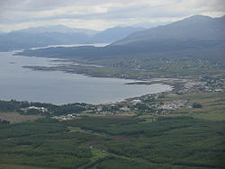
 Overlooking Broadford | |
| Location | |
| Island: | Skye |
| Grid reference: | NG642234 |
| Location: | 57°14’28"N, 5°54’25"W |
| Data | |
| Population: | 620 (est.) |
| Post town: | Isle of Skye |
| Postcode: | IV49 |
| Dialling code: | 01471 |
| Local Government | |
| Council: | Highland |
| Parliamentary constituency: |
Ross, Skye and Lochaber |
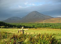
Broadford is a village on the north coast of the Isle of Skye, the largest of the Inverness-shire islands of the Inner Hebrides. It is the largest settlement on the island after Portree. It is in a beautiful, tranquil area overlooked by the dramatic spectacle of the eastern Cuillins.
Broadford lies on the southwest corner of Broadford Bay, on the A87 between Portree and the Skye Bridge.
History

Like many places in Skye, Broadford derives its name from Old Norse. To the Norse this was Breiðafjorðr; "the Wide Bay".[1] The Gaelic name An t-Àth Leathann is of modern derivation, back-formed from the English name, assuming that the "ford" element meant a river crossing.
West of Broadford in Glen Suardal, on the lower slopes of Beinn na Caillich, is Goir a' Bhlàir, 'the field of battle' (NG624234 [2]). The battle concerned was apparently a decisive action by the Gaelic Clan Mackinnon against the Norse.[2]
Broadford was a cattle market until 1812, when Thomas Telford built the road from Portree to Kyleakin. Veterans of the Napoleonic Wars settled during the first half of the 19th century. Writing in the middle of the 19th century, Alexander Smith said, "If Portree is the London of Skye, Broadford is its Manchester."[3]
Legend holds that the recipe for the liqueur Drambuie was given by Bonnie Prince Charlie to Clan MacKinnon who then passed it onto James Ross late 19th century. Ross ran the Broadford Inn (now the Broadford Hotel), where he developed and improved the recipe, initially for his friends and then later to patrons. Ross then began to sell it further afield and the name was registered as a trademark in 1893.[4]
Around the village
Geology
The mineral harkerite was first found near Broadford by the geologist Alfred Harker.[5]
Wildlife
A variety of marine life can be seen at Broadford Bay including otters[6] and occasionally killer whales.[6]
Birds that can sometimes be spotted at the bay include the Whooper Swan,[7] Brent Goose,[7] Red-throated Diver[7] and the Black-tailed Godwit.[7]
Economy
Broadford is a key service centre for southern Skye. Services include the Co-op supermarket combined with a 24-hour petrol station, a few restaurants (including the Broadford Hotel, Claymore, Dunollie Hotel, Hebridean Hotel and Red Skye), the Skye Serpentarium and a youth hostel. The local hospital is the Mackinnon Memorial Hospital.
Transport

Road
The A87 travels through Broadford, on its route from Invergarry to Uig.[8] The A851 begins at a junction with the A87, towards the east end of Broadford, and continues to Armadale.[9] Meanwhile, the B8083 begins at a junction with the A87 at the western end of Broadford, and continues to Elgol.[10]
Water
There are two piers within the vicinity of Broadford. One is at the east end of the village by the war memorial, the other and larger at Corry, at the north west end of the bay.
Air
Broadford Airfield is at nearby Ashaig. The single asphalt runway is 2,602 feet in length and oriented at 07/25.
In popular culture
- The rock band Jethro Tull have a song called "Broadford Bazaar" (on the remastered version of the Heavy Horses album) which is named after this town.
- | song entitled 'The Trip to Broadford' appears on the 1990 album Room to Roam by The Waterboys.
Outside links
| ("Wikimedia Commons" has material about Broadford) |
References
- ↑ Gammeltoft, Peder "Scandinavian Naming-Systems in the Hebrides—A Way of Understanding how the Scandinavians were in Contact with Gaels and Picts?" in Ballin Smith et al (2007) p. 484
- ↑ 2.0 2.1 Site Record for Skye, Goir A' Bhlair, Broadford, Royal Commission on the Ancient and Historical Monuments of Scotland, http://canmore.rcahms.gov.uk/en/site/11589/, retrieved 3 November 2013
- ↑ Smith, Alexander (1865). A Summer in Skye. Boston: Ticknor and Fields. pp. 98-105. http://books.google.co.uk/books?id=xSENAAAAYAAJ&pg=PA98&dq=broadford+skye&as_brr=3.
- ↑ "The Broadford Hotel is The Original Home of Drambuie". broadfordhotel.co.uk. http://www.broadfordhotel.co.uk/drambuie/. Retrieved 29 Dec 2010.
- ↑ Livingstone, Alec (2002). Minerals of Scotland. Edinburgh: National Museums of Scotland.
- ↑ 6.0 6.1 "Sightings". otter.org. Archived from the original on 21 July 2009. http://web.archive.org/web/20090721093740/http://www.otter.org/sightings.html. Retrieved 18 October 2009.
- ↑ 7.0 7.1 7.2 7.3 "Bird sightings on the Island of Skye and the neighbouring area". Skye Birds. http://www.skye-birds.com/reports. Retrieved 18 October 2009.
- ↑ "A87 route". Sabre. http://www.sabre-roads.org.uk/wiki/index.php?title=A87_route. Retrieved 2 January 2015.
- ↑ "A851". Sabre. http://www.sabre-roads.org.uk/wiki/index.php?title=A851. Retrieved 2 January 2015.
- ↑ "B8083". Sabre. http://www.sabre-roads.org.uk/wiki/index.php?title=B8083. Retrieved 2 January 2015.
Books
- Ballin Smith, Beverley; Taylor, Simon; Williams, Gareth (eds) (2007) West Over Sea: Studies in Scandinavian Sea-Borne Expansion and Settlement Before 1300. Leiden. Koninklijke Brill. ISBN 978-90-04-15893-1
