Stepney: Difference between revisions
Jump to navigation
Jump to search
Created page with '{{Infobox town | name = Stepney | county = Middlesex | picture = Stepney winterton house 1.jpg | picture caption = Winterton House, a typical Stepney tower block | os grid ref = …' |
mNo edit summary |
||
| Line 13: | Line 13: | ||
| constituency=Bethnal Green and Bow | | constituency=Bethnal Green and Bow | ||
}} | }} | ||
'''Stepney'' is a town in south-eastern [[Middlesex]] which forms part of the [[East End of London]]. It was originally named "Stebunheath", the current name being a contraction of that. | '''Stepney''' is a town in south-eastern [[Middlesex]] which forms part of the [[East End of London]]. It was originally named "Stebunheath", the current name being a contraction of that. | ||
{{stub}} | {{stub}} | ||
Latest revision as of 21:03, 4 November 2010
| Stepney | |
| Middlesex | |
|---|---|
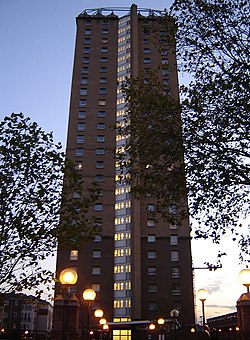
 Winterton House, a typical Stepney tower block | |
| Location | |
| Grid reference: | TQ355814 |
| Location: | 51°30’55"N, 0°2’46"W |
| Data | |
| Post town: | London |
| Postcode: | E1 |
| Dialling code: | 020 |
| Local Government | |
| Council: | Tower Hamlets |
| Parliamentary constituency: |
Bethnal Green and Bow |
Stepney is a town in south-eastern Middlesex which forms part of the East End of London. It was originally named "Stebunheath", the current name being a contraction of that.

This Middlesex article is a stub: help to improve Wikishire by building it up.