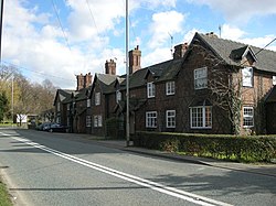
Walcote, Leicestershire
| Walcote | |
| Leicestershire | |
|---|---|
 Lutterworth Road, Walcote | |
| Location | |
| Grid reference: | SP567837 |
| Location: | 52°26’55"N, 1°9’57"W |
| Data | |
| Post town: | Lutterworth |
| Postcode: | LE17 |
| Local Government | |
| Council: | Harborough |
Walcote is a village in Leicestershire, to the east of Misterton, with which it forms a joint civil parish, named 'Misterton with Walcote': of these, Walcote is by far the larger, but Misterton has the parish church.
Walcote is on the A4304 road some two miles east if the town of Lutterworth and a mile east of Junction 20 of the M1 motorway. The village has two public houses, the Black Horse (re-opened in September 2009) and the Tavern.
A short circular walk linking Walcote and Misterton can be made by following Brook Street and taking the footpath left which joins a track which passes the Misterton Hall and St. Leonards Church. On reaching the main road, turning left onto a cyclepath by the woods of Misterton Park brings you back to Walcote.
Outside links
| ("Wikimedia Commons" has material about Walcote, Leicestershire) |
- Parish Profile
- Misterton with Walcote Parish Council
- Historic photographs
- Description and photographs of Walcot
- Misterton with Walcote Community Trust