Stanhope, County Durham
| Stanhope | |
| County Durham | |
|---|---|
 Stanhope Castle | |
| Location | |
| Grid reference: | NY995395 |
| Location: | 54°44’50"N, 2°0’22"W |
| Data | |
| Population: | 1,633 (2001) |
| Post town: | Bishop Auckland |
| Postcode: | DL13 |
| Dialling code: | 01388 |
| Local Government | |
| Council: | Durham |
| Parliamentary constituency: |
North West Durham |
Stanhope is a small market town in County Durham, on the River Wear between the villages of Eastgate and Frosterley, on the north east side of Weardale.
The A689 road across the Pennines meets the B6278 road from Barnard Castle to Shotley Bridge here.
The civil parish of Stanhope has a population of 4,519 in 2001, and also includes Rookhope, Westgate, St John's Chapel, Ireshopeburn, Wearhead, Cowshill, Cornriggs, Eastgate, Frosterley all on the A689 road, along with Crawleyside, Hill End and White Kirkley.
Places in and around the town
Stanhope is surrounded by moorland much of which is designated the North Pennines Area of Outstanding Natural Beauty.
Stanhope is also the current terminus of the Weardale Railway, a heritage railway operating primarily on weekends from Bishop Auckland with stations at Frosterley and Wolsingham.
Features of interest include:
- a petrified tree stump in the churchyard which was discovered with two others. One of the others resides in the Hancock Museum in Newcastle-Upon-Tyne
- the Durham Dales Centre which incorporates a tea room, tourist information and craft shops
- a ford with stepping stones for pedestrians
- the eighteenth century Stanhope Castle in the centre of the town stands on the possible site of a mediæval castle.
Stanhope Agricultural Show is held on the second weekend of September each year. It was founded in 1834 and has been held annually since, with the exception of the war years, the foot and mouth crisis and times of bad weather.[1]
Pictures
-
 Durham Dales Centre. Arts and Crafts Centre
 -
 The preserved station and tearoom
 -
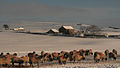 Scurfield House (Winter)
 -
 St. Thomas, Stanhope
 -
 Stone Bridge over the River Wear
 -
 Ford in Stanhope


Outside links
| ("Wikimedia Commons" has material about Stanhope, County Durham) |