Lochgilphead
Jump to navigation
Jump to search
| Lochgilphead Gaelic: Ceann Loch Gilb | |
| Argyllshire | |
|---|---|
 Lochgilphead | |
| Location | |
| Grid reference: | NR8688 |
| Location: | 56°2’24"N, 5°26’24"W |
| Data | |
| Population: | 3,000 |
| Post town: | Lochgilphead |
| Postcode: | PA30 - 31 |
| Dialling code: | 01546 |
| Local Government | |
| Council: | Argyll and Bute |
| Parliamentary constituency: |
Argyll and Bute |
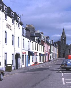
Lochgilphead is a town at the end of Loch Gilp, itself a branch of Loch Fyne, in Argyllshire. The town stands also on the banks of the Crinan Canal. It has some 3,000 inhabitants.
Lochgilphead was a planned settlement created in 1790, shortly after the completion of a road from Inveraray to Campbeltown. After the completion of the Crinan Canal in 1801 the town became more important as a link across the Kintyre peninsula.
Kilmory Castle at Lochgilphead is surrounded by a woodland park, within which are the remains of an Iron Age fort.
The town has become an administrative centre; the main offices of Argyll and Bute Council are at Kilmory Castle, and the Forestry Commission also have an office in the town.
Outside links
- http://www.argyllshireadvertiser.co.uk - The Argyllshire Advertiser for Lochgilphead and Mid Argyll news