Hartpury
| Hartpury | |
| Gloucestershire | |
|---|---|
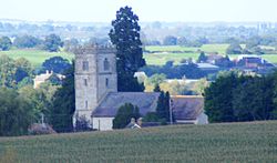
 Hartpury parish church | |
| Location | |
| Grid reference: | SO799248 |
| Location: | 51°55’40"N, 2°17’51"W |
| Data | |
| Population: | 1,642 (2011) |
| Post town: | Gloucester |
| Postcode: | GL 19 |
| Local Government | |
| Council: | Forest of Dean |
| Parliamentary constituency: |
Forest of Dean |
Hartpury is a village in Gloucestershire, on the west side of the River Severn found about five miles north of Gloucester and a mile south-west of Ashleworth village along the A417 in the Leadon Vale in the west of the county.
In a parish extending over 3,500 acres are about 270 homes and a population of about 1,642 at the 2011 census.
About the village
Hartpury also presents beautiful walks and strolls through the countryside. It has all the usual facilities; Post Office, a school, church and a vet. Hartpury College is based in the village.
The village contains several interesting buildings including the former home of the Canning family, Hartpury House , now part of the college. Hill House , also known as The Hill, is a large timber framed house which contains a very fine 16th century oak staircase and several plaster ceilings of the same period.
Outside links
| ("Wikimedia Commons" has material about Hartpury) |