File:Thrapston Bridge.jpg
From Wikishire
No higher resolution available.
Thrapston_Bridge.jpg (640 × 427 pixels, file size: 107 KB, MIME type: image/jpeg)
Summary
| Description |
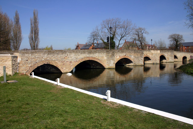
English: Nine Arch Bridge and mooring area on the River Nene at Thrapston, Northamptonshire |
| Date | |
| Source | From geograph.org.uk |
| Author | Richard Dear |
| Permission (Reusing this file) |
Creative Commons Attribution Share-alike license 2.0 |
| Attribution (required by the license) | Richard Dear / Nine Arch Bridge and mooring area, Thrapston / |
| Camera location | | View this and other nearby images on: OpenStreetMap |
|---|
Licensing

|
This image was taken from the Geograph project collection. See this photograph's page on the Geograph website for the photographer's contact details. The copyright on this image is owned by Richard Dear and is licensed for reuse under the Creative Commons Attribution-ShareAlike 2.0 license.
|
This file is licensed under the Creative Commons Attribution-Share Alike 2.0 Generic license.
Attribution: Richard Dear
- You are free:
- to share – to copy, distribute and transmit the work
- to remix – to adapt the work
- Under the following conditions:
- attribution – You must give appropriate credit, provide a link to the license, and indicate if changes were made. You may do so in any reasonable manner, but not in any way that suggests the licensor endorses you or your use.
- share alike – If you remix, transform, or build upon the material, you must distribute your contributions under the same or compatible license as the original.
Original upload log
The original description page was here. All following user names refer to en.wikipedia.
- 2008-04-01 22:20 Stavros1 640×427× (109263 bytes) A Digital Photograph of the Bridge at Thrapston taken by © Copyright Richard Dear and licensed for reuse under this Creative Commons Licence. From the Webpage: https://www.geograph.org.uk/photo/389372
File history
Click on a date/time to view the file as it appeared at that time.
| Date/Time | Thumbnail | Dimensions | User | Comment | |
|---|---|---|---|---|---|
| current | 21:05, 31 October 2009 | | 640 × 427 (107 KB) | Angusmclellan | == Summary == {{Information |Description=Nine Arch Bridge and mooring area, Thrapston |Source=From [http://www.geograph.org.uk/photo/389372 geograph.org.uk] |Date=2007-04-05 |Author=[http://www.geograph.org.uk/profile/11983 Richard Dear] |Permission=Creat |
File usage
The following file is a duplicate of this file (more details):
- File:Thrapston Bridge.jpg from a shared repository
The following 2 pages link to this file: