File:Gibraltar and Bay map 1750.jpg

Summary
| Description |
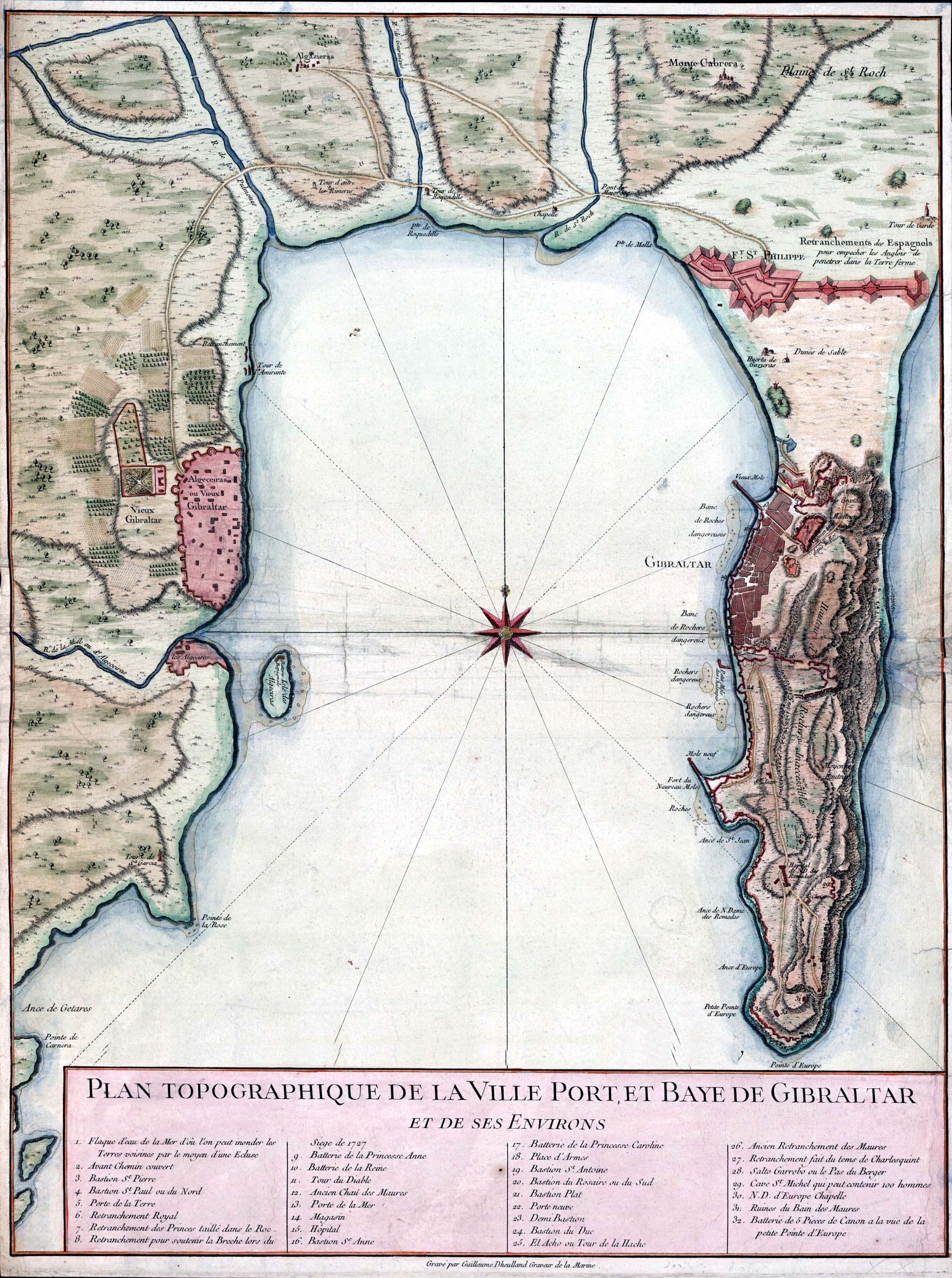
English: Topographic map of Gibraltar and the Bay of Gibraltar, circa 1750
Français : Plan Topographique De La Ville Port, Et Baye De Gibraltar, Et De Ses Environs.
Español: Plano de la Bahía de Algeciras datado en 1750. Se observan las ciudades de Algeciras y Gibraltar así como la Línea de Contravalación, fortificación construida en el istmo durante la década de 1730. |
| Date | circa 1750 |
| Source | http://www.britishempire.co.uk/images3/gibraltar1750.jpg |
| Author | Guillaume Dheulland (1700–1770) |
Licensing
|
This is a faithful photographic reproduction of a two-dimensional, public domain work of art. The work of art itself is in the public domain for the following reason:
The official position taken by the Wikimedia Foundation is that "faithful reproductions of two-dimensional public domain works of art are public domain". This photographic reproduction is therefore also considered to be in the public domain in the United States. In other jurisdictions, re-use of this content may be restricted; see Reuse of PD-Art photographs for details. {{PD-Art}} template without license parameter: please specify why the underlying work is public domain in both the source country and the United States
(Usage: {{PD-Art|1=|deathyear=''year of author's death''|country=''source country''}}, where parameter #1 can be PD-old-auto, PD-old-auto-expired, PD-old-auto-1996, PD-old-100 or similar. See Commons:Multi-license copyright tags for more information.) | ||||
File history
Click on a date/time to view the file as it appeared at that time.
| Date/Time | Thumbnail | Dimensions | User | Comment | |
|---|---|---|---|---|---|
| current | 15:41, 31 August 2007 | | 2,049 × 2,750 (877 KB) | RedCoat | {{Information |Description=18th century engraving of Gibraltar and the Bay of Gibraltar |Source=http://www.britishempire.co.uk/images3/gibraltar1750.jpg |Date=circa 1750 |Author=No illustrator given |Permission= |other_versions= }} |
File usage
The following file is a duplicate of this file (more details):
- File:Gibraltar and Bay map 1750.jpg from a shared repository
The following 2 pages link to this file: