File:English Coast.svg
From Wikishire

Size of this preview: 666 × 600 pixels. Other resolution: 266 × 240 pixels.
Original file (SVG file, nominally 1,018 × 917 pixels, file size: 4.51 MB)
Summary
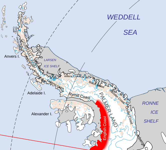
| Description | Location of the English Coast of Palmer Land, in the British Antarctic Territory | ||
| Date | |||
| Source | Map of Queen Elizabeth Land, BAT.svg | ||
| Author | Hogweard | ||
| Permission (Reusing this file) |
|
File history
Click on a date/time to view the file as it appeared at that time.
| Date/Time | Thumbnail | Dimensions | User | Comment | |
|---|---|---|---|---|---|
| current | 19:13, 19 July 2020 | | 1,018 × 917 (4.51 MB) | Hogweard | {{Information |description=Location of the English Coast of Palmer Land, in the British Antarctic Territory |date=2020-07-19 |source={{f|Map of Queen Elizabeth Land, BAT.svg}} |author={{u|Hogweard}} |permission={{PD-self}} |other versions= }} Category:Maps of the British Antarctic Territory Category:Locator maps of Antarctic Peninsula |
File usage
The following file is a duplicate of this file (more details):
- File:English Coast.svg from a shared repository
The following page links to this file: