File:British Virgin Islands locator.svg
From Wikishire

Size of this preview: 670 × 547 pixels. Other resolution: 294 × 240 pixels.
Original file (SVG file, nominally 670 × 547 pixels, file size: 515 KB)
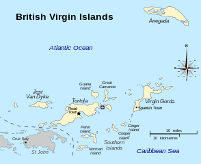
| Description | Map of the British Virgin Islands | ||
| Date | |||
| Source | British Virgin Islands in regions.svg | ||
| Author | Hogweard | ||
| Permission (Reusing this file) |
|
||
| Other versions | Macedonian/ македонски |
File history
Click on a date/time to view the file as it appeared at that time.
| Date/Time | Thumbnail | Dimensions | User | Comment | |
|---|---|---|---|---|---|
| current | 14:18, 23 October 2016 | | 670 × 547 (515 KB) | Hogweard | {{Information |Description=Map of the British Virgin Islands |Source=British Virgin Islands in regions.svg |Date=2016-10-23 |Author=Hogweard |Permission={{PD-self}} |other_versions= }} [... |
File usage
The following file is a duplicate of this file (more details):
- File:British Virgin Islands locator.svg from a shared repository
The following page links to this file: