File:Ascending Errigal - geograph.org.uk - 1459252.jpg
From Wikishire
No higher resolution available.
Ascending_Errigal_-_geograph.org.uk_-_1459252.jpg (640 × 479 pixels, file size: 386 KB, MIME type: image/jpeg)
Summary
| Description |
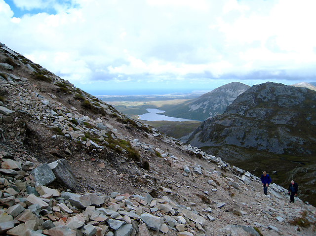
English: Ascending Errigal. The steep route to the summit of Errigal - note that the horizon here is level - and much of it is a scramble over loose quartz scree. The view in the background is towards Loch Alltáin with the coastline near Falcarragh in the background.. |
||
| Date | |||
| Source | From geograph.org.uk | ||
| Author | Ross | ||
| Permission (Reusing this file) |
This file is licensed under the Creative Commons Attribution-Share Alike 2.0 Generic license. Attribution: Ross
|

| Camera location | | View this and other nearby images on: OpenStreetMap |
|---|
_heading:0.00&language=en)
| Object location | | View this and other nearby images on: OpenStreetMap |
|---|
_heading:0.00&language=en)
File history
Click on a date/time to view the file as it appeared at that time.
| Date/Time | Thumbnail | Dimensions | User | Comment | |
|---|---|---|---|---|---|
| current | 04:35, 2 March 2011 | | 640 × 479 (386 KB) | GeographBot | == {{int:filedesc}} == {{Information |description={{en|1=Ascending Errigal The steep route to the summit of Errigal - note that the horizon here is level - and much of it is a scramble over loose quartz scree. The view in the background is towards Loch Al |
File usage
The following file is a duplicate of this file (more details):
- File:Ascending Errigal - geograph.org.uk - 1459252.jpg from a shared repository
The following page links to this file: