Deenethorpe
| Deenethorpe | |
| Northamptonshire | |
|---|---|
 Deenethorpe. | |
| Location | |
| Grid reference: | SP957919 |
| Location: | 52°31’1"N, -0°35’26"W |
| Data | |
| Population: | 133 |
| Post town: | Corby |
| Postcode: | NN17 |
| Dialling code: | 01780 |
| Local Government | |
| Council: | North Northamptonshire |
| Parliamentary constituency: |
Corby |
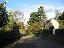
Deenethorpe is a little village in Northamptonshire, on the south-east side of the Willow Brook. Almost a mile to the north-west is its ilittle sister village, Deene, separated from Deenethorpe by Deane Park. Bulwick is two miles to the north.
In the early 1870s, Deenethorpe was described as:
"Deenethorpe parish, Northampton; 1 mile SSE of Deene village. Real property, £1, 942. Houses, 48."[1]
The population of Deenethorpe in the 1881 census was just over 200. Since then, there was a decline in the first half of the 20th century, as shown by the total population graph, where it reached a low of around 60 people. In 1960. The recorded population at the 2011 census was 133.
The 600 acres of Deenethorpe airfield (once the site of RAF Deenethorpe) was approved for a "garden village": plans include a village green, shops and community hall, as well as more than 1,000 homes.[2]
History
The village's name is derived from that of neighnbouring Deene, menaing 'Deene's outlying farm/settlement'.
Deenethorpe does not appear in the Domesday Book. Mediæval settlement remains, which were formerly part of Deenethorpe village, are found to the south of the Benefield Road and on the steep side of the valley. On the site itself, in a low mound, which has been almost entirely been ploughed out, there is an abundance of mediæval pottery, including Lyveden wares.
Common fields of the parish existed in the late 16th century and at this time there were four open fields around and to the South of Deenethorpe. There are also extensive areas of old enclosures to the South-East of the parish which existed in 1633, however by the middle of the 18th century the current fields seen today had already been made.
During the Second World War, RAF Deenethorpe was used as a purpose-built base to serve American heavy bombers. All the buildings on the site, which included administrative and accommodation blocks, were only temporary. The 401st bombardment group was based here from 3 November 1943 and 20 June 1945.[3]
St Peter's Church
St Peter's Church, Deene is the nearest church to Deenethorpe. The 13th-century estate church belonged to the Brudenell family who bought Deene Park in 1514.[4] It remains a consecrated church but is in the care of the Churches Conservation Trust.
Outside links
| ("Wikimedia Commons" has material about Deenethorpe) |
References
- ↑ Wilson, John Marius (1870–72). Imperial Gazetteer of England and Wales. Edinburgh: A. Fullerton & Co.. http://www.visionofbritain.org.uk/place/7885/writing.
- ↑ Elgot, Jessica (2017-01-02). "Fourteen garden villages to be built in England totalling 48,000 homes" (in en-GB). The Guardian. SSN 0261-3077. https://www.theguardian.com/society/2017/jan/02/fourteen-garden-villages-to-be-built-england-48000-homes-green-belt.
- ↑ "Deenethorpe | American Air Museum in Britain". http://www.americanairmuseum.com/place/106.
- ↑ "Complete list of churches". https://www.visitchurches.org.uk/visit/church-listing/st-peter-deene.html.
- Deenethorpe: RCAHME