Cotgrave
| Cotgrave | |
| Nottinghamshire | |
|---|---|
| Location | |
| Grid reference: | SK6435 |
| Location: | 52°54’36"N, 1°2’24"W |
| Data | |
| Population: | 7,373 |
| Post town: | Nottingham |
| Postcode: | NG12 |
| Dialling code: | 0115 |
| Local Government | |
| Council: | Rushcliffe |
| Parliamentary constituency: |
Rushcliffe |
Cotgrave is a village in Nottinghamshire. It may be called an old mining village, though the mines were opened in earnest only in the 1960s and closed in the 1990s. The village has refused to decline like its neighbours and has built itself anew.
There is a small shopping parade called the precinct, built at the same time that the large housing estates were developed, with a supermarket, chip-shop and the usual takeaways. The precinct is overdue for development and there are plans for this linked to the building of new homes on the nearby pit site. Near the parish church (All Saints) is a small supermarket and adjacent to that is Grannie's Tea Rooms. The leisure centre has a large swimming pool, gymnasium and sports hall with playing fields.
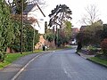
With an ancient heart that has largely escaped development Cotgrave has a village atmosphere despite a population of over 7,000. This is accented by its amenities and infrastructure that have remained comparatively underdeveloped even when the large estates were built around the village in the 1960s to house the population of workforce for the mine. It is sandwiched between the A52, A606, and A46.
Nearby to the west is Tollerton and Nottingham Airport.
Churches

The parish church is All Saints' Church, on Plumtree Road. A substantial church, it dates from the twelfth century with several alterations and additions. An arson attack in 1996 caused considerable damage but the church was since fully restored at great expense
The church enjoys a ring of eight bells, most made by Taylor's.[1] A team of ringers practice regularly (Fridays and Sundays).
Churches include:
- Church of England: All Saints
- Methodist: Cotgrave Methodist Church, dating from 1802
- Roman Catholic: Our Lady of Grace
History

A 6th-century Anglo Saxon burial ground has been excavated at Mill Hill to the north of the old village. There was certainly a Saxon church a century before the Norman invasion. The Roman road Fosse Way passes a mile to the East where it changes direction slightly.
The name "Cotgrave" is possible derived from "Cotta" (an Anglo Saxon name) and graf (grove or thicket).
The plague visited the village in 1637 killing 93 of the 500 population. This horrendous loss to the village included 46 children. All Saints was used as a food store for the village during the outbreak. Money for the goods was disinfected as it was passed through a hollowed out stone filled with vinegar to the men who had locked themselves away in the church. The stone is still in the church.[2]
On Scrimshire Lane, near the church, can be found an old wall, dubbed the "Thousand Year Wall". It is riddled with small holes made by, and providing a home for a large colony of stingless bees. Nearby, through a Lych Gate, is a graveyard that is, unusually, separated from the church by a road. There can be found a substantial war memorial, a pillar on three tiers commemorating those of the village lost in service during the World Wars. The church, too, has a stained glass window by J F Gascoyne & Son of Nottingham dedicated in 1920 as a war memorial.
Coal Mine

The town lies on the Grantham Canal, opened in 1797, but it did not grow until the discovery of coal in the area in about 1950. Smaller exploration for coal had been attempted for an hundred years but the Cotgrave colliery was established in the early 1960s when large numbers of miners and their families were relocated from other mining areas, especially County Durham and Northumberland, to live on a large purpose built housing estate.
Initially, in 1962, around 500 experienced mining workers, and their families, accepted the National Coal Board incentive of tied new houses complete with furnishings to move from the area of the recently closed Radford Mine on the northwest side of nearby Nottingham. This mine was near the site of what is now known as Bobber's Mill. Some four years later a similar scheme was introduced to attract miners from other worked out mines in the Durham, including Gateshead. According to residents, special meetings were arranged in the township so that workers already established could understand, for safety reasons, the dialect, and vice versa, of the newcomers.
The population of the village rose from around 700 to over 5,000 within a few years. A rail track was extended from Nottingham over the River Trent past Radcliffe on Trent to service the colliery. The koepe towers at the pit head were considered very modern and distinctive from more traditional pit head winding gear towers. In a departure from traditional miners' working conditions, the face workers had extensive modern changing and shower facilities that meant they could leave as clean as they entered.
The local economy was devastated with the closure of the mine in 1993/4, a move that left many former miners bitter as to their fate. Like most Nottinghamshire mines, Cotgrave continued working through the miners' strike of 1984-1985 and some felt a sense of betrayal. On the closure of the mine reports were circulated that the seams had millions of tons of coal reserves, but it was poor quality. Local residents, however, recount that the mine was shut because of geological faults, the encounter of a subterranean stream and subsequent flood problems, and the growing remoteness of the seam face from the shaft drastically increasing the cost of bringing the coal to the surface. The shafts were filled with concrete on closure and all associated buildings demolished.
The local economy has improved considerably as Cotgrave is surrounded by an affluent area with low unemployment. Many of the mine workers who hailed from the north east stayed in Cotgrave and built homes and families.
Big Society
The Cotgave Club

The Cotgrave Club was built as The Miners Welfare club in the early 1960s. It is an unremarkable building at first sight but of prestigious size boasting several large bars, garden, family and snooker rooms, entertainment suites with their own bars and one of the largest fully equipped stages in the county. The main hall is capable of seating several hundred people with its own dedicated large bar, food bar and gallery.
The various rooms and hall are available to for hire for weddings, funerals, parties, plays, pantomimes and other productions needing facilities for large audiences and refreshments. The club has a cricket and football team with grounds enough to field two football matches. There are large changing rooms and pavilion facilities for home and visiting teams.
In 2012 the club hosted the Cotgrave Festival of Sports, a variety of sporting events throughout the last week in June culminating in a finale day of presentations and entertainment. The event was successful enough, involving all the schools and community, that the town is to present the second such event, "Cotgrave Festival 2013" in June 2013. The club itself has, since the recession, suffered huge financial difficulties but has great support and is determined to survive as the heart, and "village hall" of the community.
Other Facilities
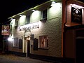
There are two primary schools. There are two pubs: The Manvers Arms, named for the Manvers family that owned much land in the area, and the Rose and Crown towards the north of the village. A third pub, the Black Diamond, was a sixties-built establishment which closed in 2006. It was demolished and replaced with housing.
There are two allotment areas in the settlement off Burrhill and Forest Close.
At the end of 2011 the people of Cotgrave launched Cotgrave Community Website.[3] This forum is paid for by the council but administrated by the council and local residents. Members are registered with their real names and checked on the electoral roll. This arrangement replaced a previous forum that allowed anonymity when posting and resulted in acrimony and resentment that is no longer present.
Country Park and canal

The extensive former mining area has been landscaped to form a country park. Here a long section of the canal has been partially restored including two locks.
The canal is not presently navigable, as nearby road bridges have been removed, though in other areas of the Nottingham Grantham canal some bridges have been rebuilt to accommodate canal traffic.[4] Plans to put the canal back to water were gradually taking shape and, as a brownfield site in a rural area, the old pit head area would prove an ideal area for the building of a marina.
This pit head area is cordoned off from public and there are plans for redevelopment which would impact the infrastructure of Cotgrave and the ongoing development of the young country park.
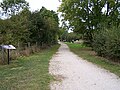
Planted woodland is now beginning to mature and the country park is gradually acquiring a diverse population of wildlife. Wildfowl abound along with reports of cuckoos, warblers, swallows, little ringed plover, yellow wagtail, ring ouzel, wheatear, chiffchaff, dabchicks. Great crested newts are reported to be established in the lake and hares, rabbits, foxes, bats and owls are present. The lake, pictured, is well stocked and is used by anglers regularly. Fishing platforms have been built around the lake and reed beds established to protect the breeding waterfowl that include a variety of ducks, coots, swans and heron. The park has a picnic area, easily accessible car parks, a gallop for the benefit of horse riders and a well marked nature trail. This features woodland, lake and canal side walks as well as taking a route along the old rail track where a short portion of the original rails and sleepers have been left in place.
A group "Friends of Cotgrave Country Park" works to maintain and improve the facilities at the park meeting regularly in Cotgrave. Details of how to become involved can be found at the Rushcliffe Council web site page dedicated to the Country Park mentioned in the links below.[5] The group has, during 2010 to 2012, helped plan and build a "swimming pool" for dogs away from the vulnerable wildlife in the country park's lake.
Outside links

- Cotgrave Community Web Site and Forum
- Cotgrave Country Park details and directions
- Satellite Map and Photographs of Cotgrave
- Cotgrave Town Council
- Cotgrave Colts YFC
- Cotgrave Welfare Diamond Angling Club
- All Saints church
-
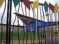
 Mining Tableaux
 -
 Risegate, Cotgrave
 -
 Rose and Crown
 -
 The Manvers Pub
 -
 The "Thousand Year Wall"
 -
 The Keepers Cottage on Notts/Grantham Canal near Cotgrave"
 -
 All Saints Cotgrave at Night
 -
 Near the canal Cotgrave Country Park
 -
 Plumtree Road Cottages in Autumn
 -
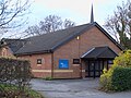
 Cotgrave Methodist Church
 -
 Cottages on Bingham Rd, Cotgrave
 -
 Ancient Way, Risegate, Cotgrave
 -
 Cotgrave Post Office
 -
 Cotgrave Futures
 -
 Candleby Lane School
 -
 Cotgrave Precinct Spring 2010
 -
 Lady of Grace RC church
 -
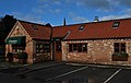 Grannies Tea Rooms
 -
 All Saints at Evening
 -
 The Welfare
 -
 Pillar near All Saints Church


