Barrow, Gloucestershire
Jump to navigation
Jump to search
| Barrow | |
| Gloucestershire | |
|---|---|
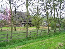
 Tump Court, The Barrow | |
| Location | |
| Grid reference: | SO884248 |
| Location: | 51°55’19"N, 2°10’8"W |
| Data | |
| Post town: | Cheltenham |
| Postcode: | GL51 |
| Local Government | |
The Barrow is a hamlet in Gloucestershire, on a loop of road in the Vale of Gloucester, close to Boddington to the north-east and Staverton to the south-east. Rural as it is the hamlet is still just two and a half miles from the edge of the swelling suburbs of Cheltenham to the east.
By the hamlet is ISS Boddington, an installation of Information Systems & Services, an operating cluster of the Ministry of Defence. It was formerly RAF Boddington, a non-flying Royal Air Force station where No. 9 Signals Unit RAF was based.
Pictures
Outside links
| ("Wikimedia Commons" has material about Barrow, Gloucestershire) |
References
- Barrow, Gloucestershire: Francis Frith