Wootton, Shropshire
From Wikishire
| Wootton | |
| Shropshire | |
|---|---|
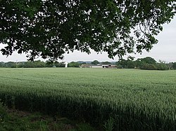
 The Leasowes near Wootton | |
| Location | |
| Grid reference: | SO457780 |
| Location: | 52°23’51"N, 2°47’54"W |
| Data | |
| Postcode: | SY7 |
| Local Government | |
| Council: | Shropshire |
Wootton is a hamlet beside the River Onny in Shropshire, just a mile from the county border with Herefordshire. It is found on the A49, which here follows the valley of the river.
The little village of Onibury is half a mile to the north, across the River Onny, and Ludlow for miles to the south-east.