Difference between revisions of "Template:FP-Rathlin Island"
From Wikishire
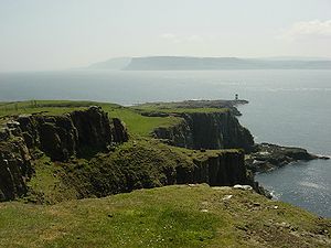
(Created page with "{{#switch:{{{1}}} |pic=South leg of Rathlin Island looking towards Fear Head.jpg |cap=The southern tip of Rathlin and the mainland of County Antrim |text='''Rathlin Island'''...") |
|||
| Line 4: | Line 4: | ||
|text='''Rathlin Island''' is an island off the north coast of [[County Antrim]]. It is the northernmost part of the county and the only inhabited offshore island of Northern Ireland, with a rising population of now just over 100 people. | |text='''Rathlin Island''' is an island off the north coast of [[County Antrim]]. It is the northernmost part of the county and the only inhabited offshore island of Northern Ireland, with a rising population of now just over 100 people. | ||
| − | The island is roughly gamma-shaped, 4 miles from east to west, and 2½ miles, rising to 440 feet at Slieveard. It lies six miles from Ballycastle and fifteen miles from the Mull of Kintyre in Argyllshire.}}<noinclude>{{ | + | The island is roughly gamma-shaped, 4 miles from east to west, and 2½ miles, rising to 440 feet at Slieveard. It lies six miles from Ballycastle and fifteen miles from the Mull of Kintyre in Argyllshire.}}<noinclude>{{FP data}} |
| − | + | ||
| − | + | ||
Latest revision as of 09:08, 9 May 2021
Rathlin IslandRathlin Island is an island off the north coast of County Antrim. It is the northernmost part of the county and the only inhabited offshore island of Northern Ireland, with a rising population of now just over 100 people. The island is roughly gamma-shaped, 4 miles from east to west, and 2½ miles, rising to 440 feet at Slieveard. It lies six miles from Ballycastle and fifteen miles from the Mull of Kintyre in Argyllshire. (Read more) |
