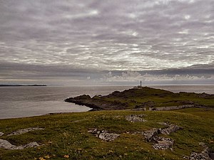
Template:FP-Inishtrahull
From Wikishire
Revision as of 12:47, 26 April 2018 by RB (Talk | contribs) (Created page with "{{#switch:{{{1}}} |pic=Across to Malin - geograph.org.uk - 1012876.jpg |cap=Inishtrahull, County Donegal |text='''Inishtrahull''' is an uninhabited island which lies in the At...")
InishtrahullInishtrahull is an uninhabited island which lies in the Atlantic Ocean to the north of Malin Head, and forms the northernmost isle of County Donegal, and consequently the northernmost island of the Republic of Ireland. The actual most northerly point of the Republic of Ireland and of County Donegal is the Tor Beg Rock, another half a mile to the north. On Inishtrahull stands the Inishtrahull Lighthouse, Ireland's northernmost lighthouse. (Read more) |
