Difference between revisions of "Stob na Cruaiche"
From Wikishire
(Created page with "{{infobox hill |name=Stob na Cruaiche |county 1=Perth |county 2=Argyll |picture=Stob na Cruaiche - geograph.org.uk - 1537854.jpg |picture caption=The triangulation pillar just...") |
(No difference)
|
Revision as of 13:23, 23 April 2018
| Stob na Cruaiche | |
| Perthshire, Argyllshire | |
|---|---|
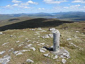
 The triangulation pillar just below the summit looking towards to Loch Rannoch | |
| Summit: | 2,425 ft NN3634157100 56°40’37"N, 4°40’22"W |
Stob na Cruaiche is a mountain on the isolated ridge which forms the border between Perthshire and Argyllshire on the north side of Rannoch Moor. It rises to a height of 2,425 ft and is thus classified as a Graham.
It can be approached either via Black Corries Lodge and the track from the Kings House to the west, or a shorter route from Rannoch Station to the east.
This Mountain or hill article is a stub: help to improve Wikishire by building it up.