Difference between revisions of "Ruardyn Castle"
(Created page with "{{Infobox castle |name=Ruardyn Castle |county=Gloucestershire |picture=Ruardean castle 2.jpg |picture caption=Ruardyn Castle |os grid ref=SO61951782 |latitude=51.857694 |longi...") |
|||
| Line 14: | Line 14: | ||
|website= | |website= | ||
}} | }} | ||
| − | '''Ruardyn Castle''' is in the village of Ruardyn, now known as [[Ruardean]]. | + | '''Ruardyn Castle''' is in the village of Ruardyn, now known as [[Ruardean]] in [[Gloucestershire]]. |
The castle was originally a manor house built in the Norman period, but because of its strategic importance it was crenellated in 1310 to become a castle. | The castle was originally a manor house built in the Norman period, but because of its strategic importance it was crenellated in 1310 to become a castle. | ||
| − | The surviving evidence suggests the site comprised a courtyard, flanked by short ranges of buildings to the north east and south west, with a tower in the western corner. A gatehouse stood to the south-east, with a hollow way leading from it towards the parish church. The site was probably enclosed by a curtain wall. | + | The surviving evidence suggests the site comprised a courtyard, flanked by short ranges of buildings to the north-east and south-west, with a tower in the western corner. A gatehouse stood to the south-east, with a hollow way leading from it towards the parish church. The site was probably enclosed by a curtain wall. |
The castle suffered major damage during the Civil War in the 17th century. | The castle suffered major damage during the Civil War in the 17th century. | ||
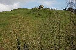
| − | Nowadays, little remains of the castle, just large mounds with some stone wall surviving on the steep bank side. By the size of the landscape that it once stood, it is suggested that it was of considerable size. | + | Nowadays, little remains of the castle, just large mounds with some stone wall surviving on the steep bank side. By the size of the landscape that it once stood, it is suggested that it was of considerable size. It is to be found down the lane next to St John the Baptist church in a field behind it. |
[[File:Ruardean castle.jpg|left|thumb|200px|The castle mound and church spire behind]] | [[File:Ruardean castle.jpg|left|thumb|200px|The castle mound and church spire behind]] | ||
Latest revision as of 08:18, 16 August 2021
| Ruardyn Castle | |
|
Gloucestershire | |
|---|---|
 Ruardyn Castle | |
| Location | |
| Grid reference: | SO61951782 |
| Location: | 51°51’28"N, 2°33’14"W |
| Village: | Ruardean |
| History | |
| Information | |
| Condition: | Bare ruins on its mound |
Ruardyn Castle is in the village of Ruardyn, now known as Ruardean in Gloucestershire.
The castle was originally a manor house built in the Norman period, but because of its strategic importance it was crenellated in 1310 to become a castle.
The surviving evidence suggests the site comprised a courtyard, flanked by short ranges of buildings to the north-east and south-west, with a tower in the western corner. A gatehouse stood to the south-east, with a hollow way leading from it towards the parish church. The site was probably enclosed by a curtain wall.
The castle suffered major damage during the Civil War in the 17th century.
Nowadays, little remains of the castle, just large mounds with some stone wall surviving on the steep bank side. By the size of the landscape that it once stood, it is suggested that it was of considerable size. It is to be found down the lane next to St John the Baptist church in a field behind it.
