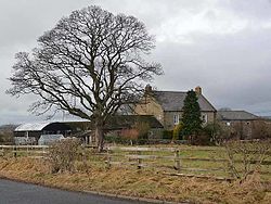
Ouston, Stamfordham
From Wikishire
Revision as of 07:22, 4 February 2016 by RB (Talk | contribs) (Created page with "{{Infobox town |name=Ouston |county=Northumberland |picture=Ouston Farm (geograph 2231905).jpg |picture caption=Ouston Farm |latitude=55.0289 |longitude=-1.8842 |os grid ref=N...")
| Ouston | |
| Northumberland | |
|---|---|
 Ouston Farm | |
| Location | |
| Grid reference: | NZ075705 |
| Location: | 55°1’44"N, 1°53’3"W |
| Data | |
| Post town: | Newcastle-upon-Tyne |
| Postcode: | NE18 |
| Dialling code: | 01661 |
| Local Government | |
| Council: | Northumberland |
| Parliamentary constituency: |
Hexham |
Ouston is a village in Northumberland, near Stamfordham, to whose parish it belongs, in the south of the county. It is close by the course of Hadrian's Wall
This Northumberland article is a stub: help to improve Wikishire by building it up.