Difference between revisions of "Mweelrea"
From Wikishire
m |
|||
| Line 8: | Line 8: | ||
|range= | |range= | ||
|os grid ref=L789668 | |os grid ref=L789668 | ||
| + | |latitude=53.6381 | ||
| + | |longitude=-9.8301 | ||
}} | }} | ||
| − | '''Mweelrea''' is a mountain in [[County Mayo | + | '''Mweelrea''' is a mountain in [[County Mayo]]. It rises to a height of 2,670 feet, which makes it the [[County top#County tops in the Republic of Ireland|highest point]] in County Mayo, and indeed the highest point in the [[Provinces of Ireland|Province]] of [[Connaught]] |
Mweelrea overlooks [[Killary Harbour]], the long, deep, remote sea loch between Mayo and [[County Galway|Galway]]. | Mweelrea overlooks [[Killary Harbour]], the long, deep, remote sea loch between Mayo and [[County Galway|Galway]]. | ||
Latest revision as of 10:57, 27 March 2018
| Mweelrea | |
| County Mayo | |
|---|---|
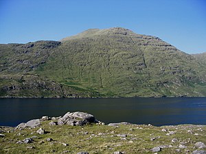
 Mweelrea over Killary Harbour | |
| Summit: | 2,670 feet L789668 53°38’17"N, 9°49’48"W |
Mweelrea is a mountain in County Mayo. It rises to a height of 2,670 feet, which makes it the highest point in County Mayo, and indeed the highest point in the Province of Connaught
Mweelrea overlooks Killary Harbour, the long, deep, remote sea loch between Mayo and Galway.
The mountain's name is form the Irish Maol Réidh; the Gaelic Cnoc Maol Réidh means "smooth bald hill".
Mweelrea is relatively easy for novice climbers to negotiate, and provides some stunning views of the surrounding area, including views of County Galway and Mayo, and the Atlantic Ocean.