Difference between revisions of "Hennock"
From Wikishire
(Created page with "{{Infobox town |name=Hennock |county=Devon |picture=Palk Arms - Hennock - geograph.org.uk - 640009.jpg |picture caption=The Palk Arms, Hennock |os grid ref=SX830808 |latitude=...") |
(No difference)
|
Latest revision as of 21:58, 19 October 2018
| Hennock | |
| Devon | |
|---|---|
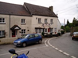
 The Palk Arms, Hennock | |
| Location | |
| Grid reference: | SX830808 |
| Location: | 50°36’55"N, 3°39’16"W |
| Data | |
| Postcode: | TQ13 |
| Local Government | |
Hennock is a hamlet on Dartmoor, to the north of Bovey Tracey, by the eastern edge of the moor above the valley of the River Teign.
The cottages of the hamlet are gathered around the church, St Mary The Virgin.