Garvaghey
From Wikishire
Revision as of 21:50, 2 December 2022 by RB (Talk | contribs) (Created page with "{{Infobox town |name=Garvaghey |county=Tyrone |picture=Barn, Garvaghy - geograph.org.uk - 1225060.jpg |picture caption=Barn, Garvaghy |os grid ref=H561604 |latitude=54.489 |lo...")
| Garvaghey | |
| Tyrone | |
|---|---|
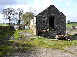
 Barn, Garvaghy | |
| Location | |
| Grid reference: | H561604 |
| Location: | 54°29’20"N, 7°8’6"W |
| Data | |
| Dialling code: | 028 |
| Local Government | |
Garvaghey or Garvaghy is a townland and hamlet in Tyrone, found between Ballygawley (about five miles to the south-east) and Omagh (eleven miles to the north-west).
| ("Wikimedia Commons" has material about Garvaghey) |
