Difference between revisions of "Four shire stone"
(→Boundary marker) |
|||
| Line 1: | Line 1: | ||
| + | {{county|Gloucester}} | ||
[[File:Four_shire_stone.jpg|thumb|right|The Four shire stone]] | [[File:Four_shire_stone.jpg|thumb|right|The Four shire stone]] | ||
| Line 12: | Line 13: | ||
== References == | == References == | ||
| − | |||
{{reflist}} | {{reflist}} | ||
== Outside links == | == Outside links == | ||
| + | *Location map: {{wmap|51.9875|-1.665833|zoom=14|base=colour_detached|name=Four shire stone}} | ||
* [http://www.rootsweb.ancestry.com/~engcots/4ShireStonePhotos.html Pictures of the Four shire stone]. | * [http://www.rootsweb.ancestry.com/~engcots/4ShireStonePhotos.html Pictures of the Four shire stone]. | ||
Latest revision as of 07:59, 5 April 2018

The Four shire stone is a boundary marker that marks the place where the four counties of Gloucester, Oxford, Warwick and Worcester meet.
Boundary marker
It is not a stone, but a nine-foot high monument, built from the local Cotswold stone. It is located a mile and a half east of the town of Moreton-in-Marsh. The existing structure was probably built in the 18th century, and is a grade II listed building.[1] There was an earlier "4 Shire Stone" on or near the site in 1675.[2]
From the stone, one can go either east or west into Gloucestershire (east into the detached part of Little Compton), north into Warwickshire, south-east into Oxfordshire, or south-west into Worcestershire (detached). Most of Worcestershire is to the north-west of the stone. Thus the order of the four counties around the stone differs from what one might expect from a standard map.
It is claimed that the Four shire stone inspired the "Three-Farthing Stone" in Tolkien's books The Hobbit and The Lord of the Rings. In those books, The Shire is divided into four farthings, three of which meet at the "Three-Farthing Stone".[3][4]
References
- ↑ "British Listed Buildings". http://www.britishlistedbuildings.co.uk/en-305989-four-shire-stone-evenlode-gloucestershir. Retrieved 12 August 2013.
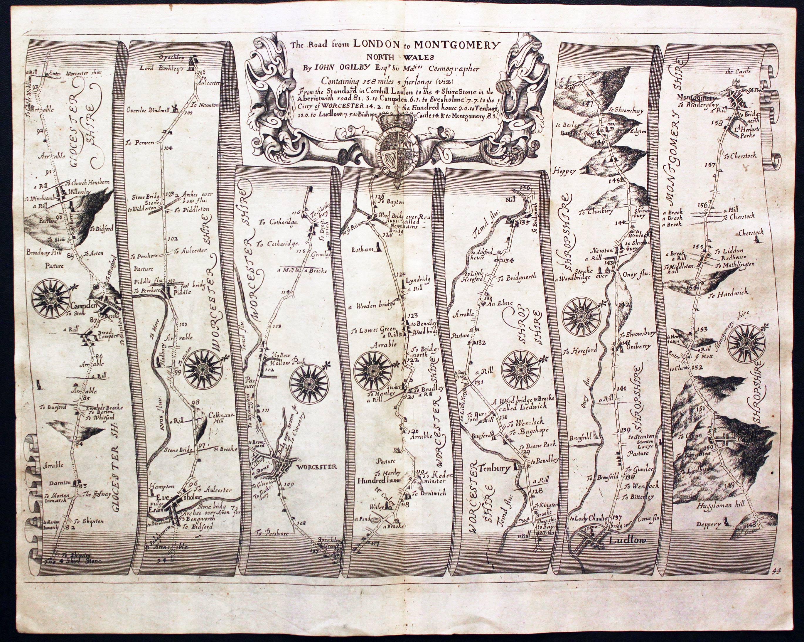
- ↑ Ogilby, John (1675). Britannia Atlas. Richard Nicholson of Chester, map dealer. p. Plate 44. http://www.antiquemaps.com/uk/mzoom/29411.jpg. Retrieved 1 October 2013.
- ↑ "Moreton-in-Marsh Tourist Information and Travel Guide". cotswolds.info. http://www.cotswolds.info/places/moreton-in-marsh.shtml. Retrieved 12 August 2013.
- ↑ Hooker, Mark T. (2009). The Hobbitonian Anthology. Llyfrawr. p. 98-99. ISBN 978-1448617012.
Outside links
- Location map: 51°59’15"N, 1°39’57"W
- Pictures of the Four shire stone.