File:Wrotham3602.JPG
From Wikishire

Size of this preview: 800 × 600 pixels. Other resolution: 320 × 240 pixels.
Original file (2,848 × 2,136 pixels, file size: 1.47 MB, MIME type: image/jpeg)
| Description |
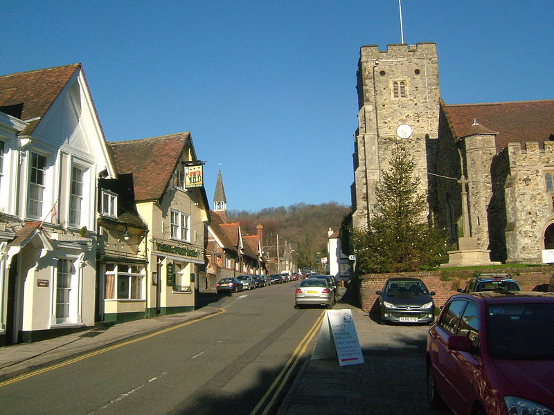
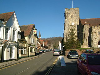
Wrotham in Kent, is a parish in Kent, England, south of Gravesend. The High Street and church, looking to the ridge of the North Downs. At the end of the street the road dips and there are the en:Pilgrims' Way, the A20 and the M20. The High Street was the main road from Gravesend to Tonbridge.
|
||||
| Date | |||||
| Source | Own work | ||||
| Author | Clem Rutter, Rochester Kent | ||||
| Permission (Reusing this file) |
Own work, copyleft: Multi-license with GFDL and Creative Commons CC-BY-SA-2.5 and older versions (2.0 and 1.0) |
I, the copyright holder of this work, hereby publish it under the following licenses:

|
Permission is granted to copy, distribute and/or modify this document under the terms of the GNU Free Documentation License, Version 1.2 or any later version published by the Free Software Foundation; with no Invariant Sections, no Front-Cover Texts, and no Back-Cover Texts. A copy of the license is included in the section entitled GNU Free Documentation License. |
| This file is licensed under the Creative Commons Attribution-Share Alike 3.0 Unported license. | ||
| ||
| This licensing tag was added to this file as part of the GFDL licensing update. |
This file is licensed under the Creative Commons Attribution-Share Alike 2.5 Generic, 2.0 Generic and 1.0 Generic license.
- You are free:
- to share – to copy, distribute and transmit the work
- to remix – to adapt the work
- Under the following conditions:
- attribution – You must give appropriate credit, provide a link to the license, and indicate if changes were made. You may do so in any reasonable manner, but not in any way that suggests the licensor endorses you or your use.
- share alike – If you remix, transform, or build upon the material, you must distribute your contributions under the same or compatible license as the original.
You may select the license of your choice.
File history
Click on a date/time to view the file as it appeared at that time.
| Date/Time | Thumbnail | Dimensions | User | Comment | |
|---|---|---|---|---|---|
| current | 19:38, 12 December 2007 | | 2,848 × 2,136 (1.47 MB) | ClemRutter | {{Information |Description=Wrotham in Kent, is a parish in Kent, England, south of Gravesend. The High Street and church, looking to the ridge of the North Downs. At the end of the street the road dips and there a |
File usage
The following file is a duplicate of this file (more details):
- File:Wrotham3602.JPG from a shared repository
The following page links to this file: