File:Vale of Edale001.jpg
From Wikishire

Size of this preview: 800 × 600 pixels. Other resolution: 320 × 240 pixels.
Original file (2,592 × 1,944 pixels, file size: 1.27 MB, MIME type: image/jpeg)
Summary
| Description |
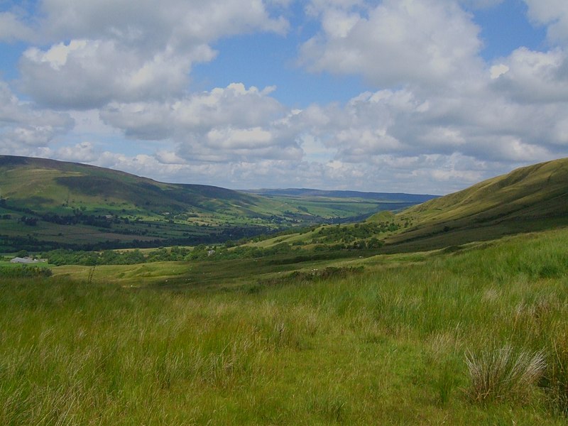
Edale Derbyshire, Peak District. (pron. Ee-dale) is a small Derbyshire village and Civil parish in the Peak District, in the Midlands of England. The Parish of Edale, area 2,844.8ha,[2] is in the Borough of High Peak. Edale is best known to serious walkers as the start (or southern end) of the Pennine Way, and to less-ambitious walkers as a good starting point for beautiful evening or day Peak District walks, reachable by public transport from Sheffield or Manchester, and with two pubs which both supply real ale and food.
|
||||
| Date | |||||
| Source | Vale of Edale | ||||
| Author | Siobhan Brennan-Raymond from Doncaster,South Yorkshire, UK |
Licensing
This file is licensed under the Creative Commons Attribution 2.0 Generic license.
- You are free:
- to share – to copy, distribute and transmit the work
- to remix – to adapt the work
- Under the following conditions:
- attribution – You must give appropriate credit, provide a link to the license, and indicate if changes were made. You may do so in any reasonable manner, but not in any way that suggests the licensor endorses you or your use.
| This image was originally posted to Flickr by Weeping-Willow at https://www.flickr.com/photos/9346632@N07/929699298. It was reviewed on 15 February 2008 by FlickreviewR and was confirmed to be licensed under the terms of the cc-by-2.0. |
File history
Click on a date/time to view the file as it appeared at that time.
| Date/Time | Thumbnail | Dimensions | User | Comment | |
|---|---|---|---|---|---|
| current | 20:12, 14 February 2008 | | 2,592 × 1,944 (1.27 MB) | Victuallers | {{Information |Description= Edale Derbyshire, Peak District. (pron. Ee-dale) is a small Derbyshire village and Civil parish in the Peak District, in the Midlands of England. The Parish of Edale, area 2,844.8ha,[2] is in the Borough of High Pe |
File usage
The following file is a duplicate of this file (more details):
- File:Vale of Edale001.jpg from a shared repository
The following page links to this file: