File:The Hundred Foot Washes - geograph.org.uk - 620961.jpg
From Wikishire

Size of this preview: 395 × 599 pixels. Other resolution: 158 × 240 pixels.
Original file (422 × 640 pixels, file size: 117 KB, MIME type: image/jpeg)
Summary
| Description |
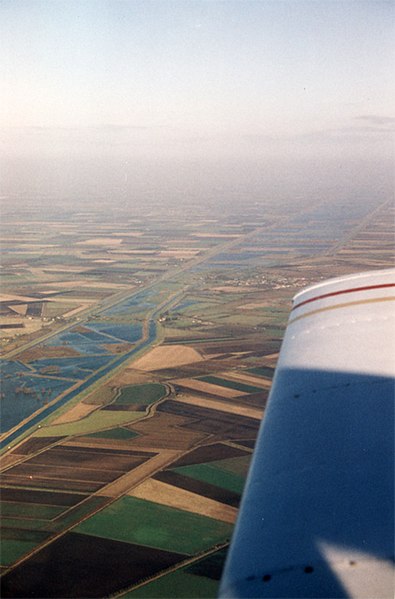
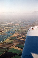
English: The Hundred Foot Washes A view of these fenland drainage systems during the winter when the area between the new and Old Bedford Rivers is allowed to flood - providing valuable wetland areas for whooper swans and other waterfowl. Sometimes referred to as the Hundred foot Drain, it is a spectacular landmark from the air. On a quiet summers day whilst flying back this way to base, I was asked by a bored US military air traffic controller to give my exact position. I replied - 'over the southwestern end of the hundred foot Drain'. Confused silence from air traffic control followed :-) The village in the centre of the photo is Mepal. |
| Date | |
| Source | From geograph.org.uk |
| Author | Martin Addison |
| Attribution (required by the license) | Martin Addison / The Hundred Foot Washes / |
| Camera location | | View this and other nearby images on: OpenStreetMap |
|---|
_heading:22.00&language=en)
| Object location | | View this and other nearby images on: OpenStreetMap |
|---|
_heading:22.00&language=en)
Licensing

|
This image was taken from the Geograph project collection. See this photograph's page on the Geograph website for the photographer's contact details. The copyright on this image is owned by Martin Addison and is licensed for reuse under the Creative Commons Attribution-ShareAlike 2.0 license.
|
This file is licensed under the Creative Commons Attribution-Share Alike 2.0 Generic license.
Attribution: Martin Addison
- You are free:
- to share – to copy, distribute and transmit the work
- to remix – to adapt the work
- Under the following conditions:
- attribution – You must give appropriate credit, provide a link to the license, and indicate if changes were made. You may do so in any reasonable manner, but not in any way that suggests the licensor endorses you or your use.
- share alike – If you remix, transform, or build upon the material, you must distribute your contributions under the same or compatible license as the original.
- Remove redundant categories and try to put this image in the most specific category/categories
- Remove this template
- The location categories are based on information from this geonames tool and this OpenStreetMap tool combined with a database. You can also have a look at this tool from mysociety.
- The topic category from Geograph was Aerial photo (find similar images photo at Geograph)
File history
Click on a date/time to view the file as it appeared at that time.
| Date/Time | Thumbnail | Dimensions | User | Comment | |
|---|---|---|---|---|---|
| current | 07:12, 7 February 2011 | | 422 × 640 (117 KB) | GeographBot | == {{int:filedesc}} == {{Information |description={{en|1=The Hundred Foot Washes A view of these fenland drainage systems during the winter when the area between the new and Old Bedford Rivers is allowed to flood - providing valuable wetland areas for who |
File usage
The following file is a duplicate of this file (more details):
- File:The Hundred Foot Washes - geograph.org.uk - 620961.jpg from a shared repository
The following 2 pages link to this file: