File:Shirley Fountain.jpg
From Wikishire

Size of this preview: 450 × 600 pixels. Other resolution: 180 × 240 pixels.
Original file (480 × 640 pixels, file size: 94 KB, MIME type: image/jpeg)
Summary
| Camera location | | View this and other nearby images on: OpenStreetMap |
|---|
| Object location | | View this and other nearby images on: OpenStreetMap |
|---|
_region:GB-ENG_heading:292.00&language=en)
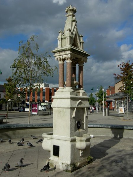
| Description | Drinking Fountain. Southampton, City of Southampton, Great Britain |
| Date | 14 December 2006 (original upload date) |
| Source |
https://www.geograph.org.uk/photo/259057 Originally from en.wikipedia; description page is/was here. |
| Author | Dennis Huteson |
Licensing
This file is licensed under the Creative Commons Attribution-Share Alike 2.0 Generic license.
- You are free:
- to share – to copy, distribute and transmit the work
- to remix – to adapt the work
- Under the following conditions:
- attribution – You must give appropriate credit, provide a link to the license, and indicate if changes were made. You may do so in any reasonable manner, but not in any way that suggests the licensor endorses you or your use.
- share alike – If you remix, transform, or build upon the material, you must distribute your contributions under the same or compatible license as the original.

|
This image was taken from the Geograph project collection. See this photograph's page on the Geograph website for the photographer's contact details. The copyright on this image is owned by Dennis Huteson and is licensed for reuse under the Creative Commons Attribution-ShareAlike 2.0 license.
|
This file is licensed under the Creative Commons Attribution-Share Alike 2.0 Generic license.
Attribution: Dennis Huteson
- You are free:
- to share – to copy, distribute and transmit the work
- to remix – to adapt the work
- Under the following conditions:
- attribution – You must give appropriate credit, provide a link to the license, and indicate if changes were made. You may do so in any reasonable manner, but not in any way that suggests the licensor endorses you or your use.
- share alike – If you remix, transform, or build upon the material, you must distribute your contributions under the same or compatible license as the original.
Original upload log
(All user names refer to en.wikipedia)
- 2006-12-14 18:33 Waggers 480×640×8 (96134 bytes) Source: https://www.geograph.org.uk/photo/259057
File history
Click on a date/time to view the file as it appeared at that time.
| Date/Time | Thumbnail | Dimensions | User | Comment | |
|---|---|---|---|---|---|
| current | 13:47, 18 March 2007 | | 480 × 640 (94 KB) | Stanmar | {{Information |Description=Drinking Fountain. Southampton, City of Southampton, Great Britain |Source=http://www.geograph.org.uk/photo/259057 Originally from [http://en.wikipedia.org en.wikipedia]; description page is/was [http://en.wikipedia.org/w/index |
File usage
The following file is a duplicate of this file (more details):
- File:Shirley Fountain.jpg from a shared repository
The following page links to this file: