File:Near Portarlington, County Laois - geograph.org.uk - 1815831.jpg
From Wikishire

Size of this preview: 800 × 431 pixels. Other resolution: 320 × 172 pixels.
Original file (3,888 × 2,094 pixels, file size: 3.19 MB, MIME type: image/jpeg)
Summary
| Description |
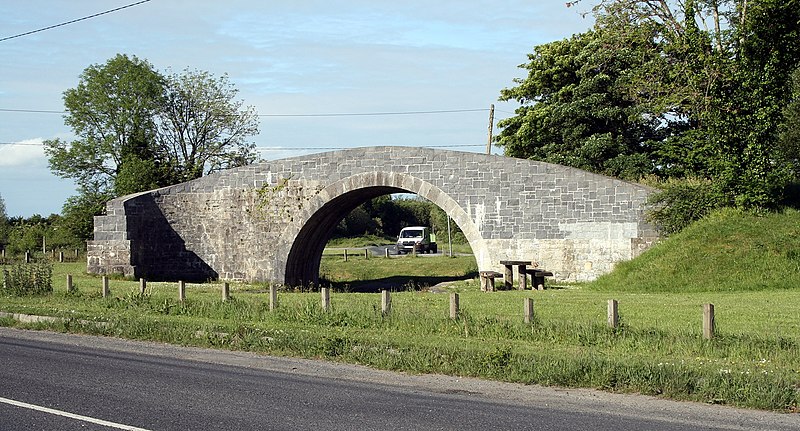
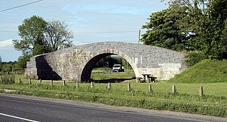
English: Blackhall Bridge, near Portarlington, County Laois, near to Ballymorris, Kilbride, Kilnahown Bridge, Cuil an Tsudaire and Tirhogar Cross Roads, Laois, Ireland.
From the R419 - a bridge carrying a no longer existing road over a no longer existing canal. |
| Date | |
| Source | From this image at geograph.org.uk; transferred by User:RHaworth using geograph_org2commons. |
| Author | sarah777 |
| Permission (Reusing this file) |
Creative Commons Attribution Share-alike license 2.0 |
| Camera location | | View this and other nearby images on: OpenStreetMap |
|---|
| Object location | | View this and other nearby images on: OpenStreetMap |
|---|
_region:IE_heading:67.00&language=en)
Licensing

|
This image was taken from the Geograph project collection. See this photograph's page on the Geograph website for the photographer's contact details. The copyright on this image is owned by sarah777 and is licensed for reuse under the Creative Commons Attribution-ShareAlike 2.0 license.
|
This file is licensed under the Creative Commons Attribution-Share Alike 2.0 Generic license.
Attribution: sarah777
- You are free:
- to share – to copy, distribute and transmit the work
- to remix – to adapt the work
- Under the following conditions:
- attribution – You must give appropriate credit, provide a link to the license, and indicate if changes were made. You may do so in any reasonable manner, but not in any way that suggests the licensor endorses you or your use.
- share alike – If you remix, transform, or build upon the material, you must distribute your contributions under the same or compatible license as the original.
File history
Click on a date/time to view the file as it appeared at that time.
| Date/Time | Thumbnail | Dimensions | User | Comment | |
|---|---|---|---|---|---|
| current | 21:09, 21 April 2010 | | 3,888 × 2,094 (3.19 MB) | File Upload Bot (Magnus Manske) | == {{int:filedesc}} == {{Information |Description={{en|1=Near Portarlington, County Laois, near to Ballymorris, Kilbride, Kilnahown Bridge, Cuil an Tsudaire</b> and Tirhogar Cross Roads, Laois, Ireland. From the R419 - a bridge carrying a no longer exist |
File usage
The following file is a duplicate of this file (more details):
- File:Near Portarlington, County Laois - geograph.org.uk - 1815831.jpg from a shared repository
The following page links to this file: