File:Dominican College Newbridge.jpg
From Wikishire

Size of this preview: 771 × 600 pixels. Other resolution: 309 × 240 pixels.
Original file (1,844 × 1,434 pixels, file size: 957 KB, MIME type: image/jpeg)
Summary
| Description |
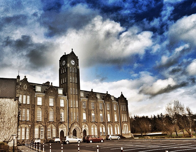
English: Newbridge College second-level school in Co. Kildare, Ireland. |
| Date | |
| Source | http://www.geograph.ie/photo/3852834 |
| Author | Anna Watson |
| Attribution (required by the license) | Anna Watson / Newbridge College / |
| Object location | | View this and other nearby images on: OpenStreetMap |
|---|
_&language=en)
Licensing

|
This image was taken from the Geograph project collection. See this photograph's page on the Geograph website for the photographer's contact details. The copyright on this image is owned by Anna Watson and is licensed for reuse under the Creative Commons Attribution-ShareAlike 2.0 license.
|
This file is licensed under the Creative Commons Attribution-Share Alike 2.0 Generic license.
Attribution: Anna Watson
- You are free:
- to share – to copy, distribute and transmit the work
- to remix – to adapt the work
- Under the following conditions:
- attribution – You must give appropriate credit, provide a link to the license, and indicate if changes were made. You may do so in any reasonable manner, but not in any way that suggests the licensor endorses you or your use.
- share alike – If you remix, transform, or build upon the material, you must distribute your contributions under the same or compatible license as the original.
|
The photographical reproduction of this work is covered under the article §93 of the Irish copyright law, which states that it is permitted for photographers to take pictures of sculptures, buildings, and works of artistic craftsmanship that are permanently located in a public place or premises open to the public, and to publish such pictures in any way.
See COM:CRT/Ireland#Freedom of panorama for more information.
|
File history
Click on a date/time to view the file as it appeared at that time.
| Date/Time | Thumbnail | Dimensions | User | Comment | |
|---|---|---|---|---|---|
| current | 18:34, 3 February 2018 | | 1,844 × 1,434 (957 KB) | Geograph Update Bot | Higher-resolution version from Geograph. |
File usage
The following file is a duplicate of this file (more details):
- File:Dominican College Newbridge.jpg from a shared repository
The following page links to this file: