File:Anguilla ponds map.svg
From Wikishire

Size of this preview: 800 × 487 pixels. Other resolution: 320 × 195 pixels.
Original file (SVG file, nominally 5,018 × 3,055 pixels, file size: 970 KB)
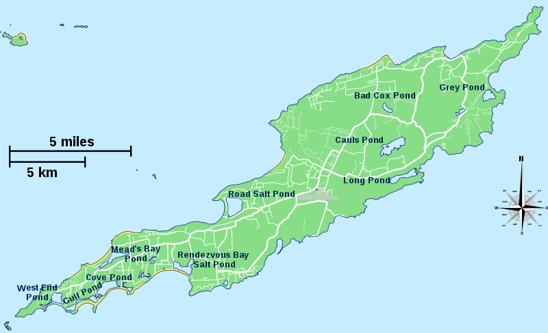
| Description | Map of Anguilla showing the ponds | ||
| Date | |||
| Source | Anguilla map.svg | ||
| Author | Hogweard | ||
| Permission (Reusing this file) |
|
File history
Click on a date/time to view the file as it appeared at that time.
| Date/Time | Thumbnail | Dimensions | User | Comment | |
|---|---|---|---|---|---|
| current | 22:27, 3 May 2017 | | 5,018 × 3,055 (970 KB) | Hogweard | {{Information |Description=Map of Anguilla showing the ponds |Source={{f|Anguilla map.svg}} |Date=2017-05-03 |Author={{u|Hogweard}} |Permission={{PD-self}} |other_versions= }} Category:Maps of Anguilla |
File usage
The following file is a duplicate of this file (more details):
- File:Anguilla ponds map.svg from a shared repository
The following 10 pages link to this file: