Eynesbury Hardwicke
| Eynesbury Hardwicke | |
| Huntingdonshire | |
|---|---|

| |
| Location | |
| Grid reference: | TL2056 |
| Location: | 52°11’38"N, 0°14’20"W |
| Data | |
| Post town: | St Neots |
| Postcode: | PE19 |
| Dialling code: | 01480 |
| Local Government | |
| Council: | Huntingdonshire |
Eynesbury Hardwicke is a village in Huntingdonshire. It is the part of the old parish of Eynesbury which has escaped becoming part of St Neots.
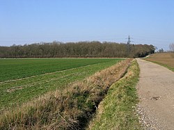
Eynesbury Hardwicke lies on the south-east side of St Neots. It is a farming parish with neither village as such nor church. Eynesbury Hardwicke House dates from the 17th Century whilst also in the parish is Caldecote Manor which was largely rebuilt in the 18th Century.
Eynesbury Hardwicke was probably part of Eynesbury parish in 1086 and it was only in 1895 that Eynesbury was split in two,[1] so that most of the village of Eynesbury could be incorporated into the town of St Neots. Eynesbury is indeed is seemlessly part of the latter's townscape today.
Eynesbury Hardwicke parish was formed by 2,641 acres of land in two separate pieces, and 8 acres of water.[1]
Caldecote Manor, Eynesbury Hardwicke House and the site of an abandoned village, Weald.[2]
References
- ↑ 1.0 1.1 Page, William; Proby, Granville; Inskip Ladds, S. (editors) (1932). A History of the County of Huntingdon: Volume 2. London. pp. 272–280. http://www.british-history.ac.uk/report.aspx?compid=42499.
- ↑ "Ancient "lost" villages of Huntingdonshire". Ancient village sites. The County of Huntingdonshire UK. http://www.huntingdonshire.info/history/2_4_ancient_villages.htm. Retrieved 2 December 2009.