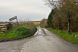
East Taphouse
From Wikishire
Revision as of 22:39, 28 July 2016 by RB (Talk | contribs) (Created page with "{{Infobox town |name=East Taphouse |county=Cornwall |picture=Herodsfoot Road, East Taphouse - geograph-3855894.jpg |picture caption=Herodsfoot Road, East Taphouse |os grid ref...")
| East Taphouse | |
| Cornwall | |
|---|---|
 Herodsfoot Road, East Taphouse | |
| Location | |
| Grid reference: | SX182635 |
| Location: | 50°26’28"N, 4°33’54"W |
| Data | |
| Postcode: | PL14 |
| Local Government | |
| Parliamentary constituency: |
Cornwall |
East Taphouse is a little village in Cornwall, within the Parish of St Pinnock, one mile west of Doublebois on the A390 Liskeard to St Austell road.
A little further west are the hamlets of Middle Taphouse and West Taphouse.
Outside links
| ("Wikimedia Commons" has material about East Taphouse) |