Difference between revisions of "Bulstake Stream"
m (→References) |
|||
| Line 1: | Line 1: | ||
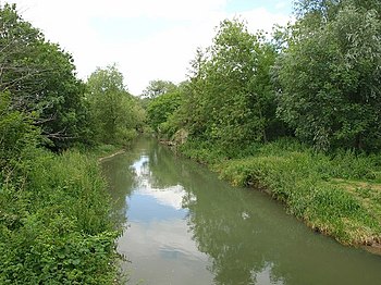
[[File:Bulstake Stream - geograph.org.uk - 872836.jpg|right|thumb|350px|Bulstake Stream at New Botley]] | [[File:Bulstake Stream - geograph.org.uk - 872836.jpg|right|thumb|350px|Bulstake Stream at New Botley]] | ||
| − | '''Bulstake Stream''', also spelt '''Bullstake Stream''', is a backwater of the [[River Thames]] at [[Oxford]]. It leaves the main stream of the Thames at a river junction known as Four Rivers, at the south west corner of [[Fiddler's Island]], running | + | '''Bulstake Stream''', also spelt '''Bullstake Stream''', is a backwater of the [[River Thames]] at [[Oxford]]. It leaves the main stream of the Thames at a river junction known as Four Rivers, at the south-west corner of [[Fiddler's Island]], running west of the main line of the Thames. |
| − | The stream immediately flows past Tumbling Bay, the site of a bathing place in use from 1853 to 1990.<ref>{{cite web|last=Graham|first=Malcolm|title=TUM 150: Recreation at Tumbling Bay 1853-2010|url=http://www.oxfordsoftwaredocumentation.com/wowg/tumbling_bay.html|accessdate=2011-02-03}}.</ref> It follows a semi-circular course, west and then south, passing under bridges on Binsey Lane and [[Botley Road]] to a confluence with [[Seacourt Stream]] near [[North Hinksey]]. It then flows east past [[Osney Mead]] Industrial Estate, and rejoins the Thames at the Osney Rail Bridge. The [[Thames Path]] crosses the stream on a bridge known as Boney's Bridge.<ref>[http://thames.me.uk/s01740.htm Where Thames Smooth Waters Glide: Osney Railway Bridge]</ref> | + | The stream immediately flows past Tumbling Bay, the site of a bathing place in use from 1853 to 1990.<ref>{{cite web|last=Graham|first=Malcolm|title=TUM 150: Recreation at Tumbling Bay 1853-2010|url=http://www.oxfordsoftwaredocumentation.com/wowg/tumbling_bay.html|accessdate=2011-02-03}}.</ref> It follows a semi-circular course, west and then south, passing under bridges on Binsey Lane and [[Botley Road]], briefly forming the county border with [[Berkshire]] to a confluence with [[Seacourt Stream]] near [[North Hinksey]]. It then flows east past [[Osney Mead]] Industrial Estate, and rejoins the Thames at the Osney Rail Bridge. The [[Thames Path]] crosses the stream on a bridge known as Boney's Bridge.<ref>[http://thames.me.uk/s01740.htm Where Thames Smooth Waters Glide: Osney Railway Bridge]</ref> |
The stream between Seacourt Stream and the Thames is also known as Potts Stream or Pot Stream. | The stream between Seacourt Stream and the Thames is also known as Potts Stream or Pot Stream. | ||
| − | Until 1790, the stream was the main navigation channel of the Thames.<ref>{{cite book |last1=Crossley |first1=Alan |last2=Elrington |first2=C.R. (eds.) |authorlink2=Christopher Elrington |last3=Chance |first3=Eleanor |last4=Colvin |first4=Christina |last5=Cooper |first5=Janet |last6=Day |first6=C.J. |last7=Hassall |first7=T.G. |last8=Selwyn |first8=Nesta |series=Victoria County History |title=A History of the County of Oxford, Volume 4: Communications: Rivers and River Navigation |date=1979 |publisher=|location=|isbn=|pages=|url=http://www.british-history.ac.uk/report.aspx?compid=22808#s5}}</ref> It became a backwater when Osney Lock was opened. | + | Until 1790, the stream was the main navigation channel of the Thames.<ref>{{cite book |last1=Crossley |first1=Alan |last2=Elrington |first2=C.R. (eds.) |authorlink2=Christopher Elrington |last3=Chance |first3=Eleanor |last4=Colvin |first4=Christina |last5=Cooper |first5=Janet |last6=Day |first6=C.J. |last7=Hassall |first7=T.G. |last8=Selwyn |first8=Nesta |series=Victoria County History |title=A History of the County of Oxford, Volume 4: Communications: Rivers and River Navigation |date=1979 |publisher=|location=|isbn=|pages=|url=http://www.british-history.ac.uk/report.aspx?compid=22808#s5}}</ref> It became a backwater when [[Osney Lock]] was opened. |
==Outside links== | ==Outside links== | ||
| Line 13: | Line 13: | ||
==References== | ==References== | ||
{{Reflist}} | {{Reflist}} | ||
| − | + | [[Category:Rivers of Berkshire]] | |
| − | [[Category:Rivers of Berkshire]] [[Category:Backwaters of the River Thames]] | + | [[Category:Rivers of Oxfordshire]] |
| + | [[Category:Backwaters of the River Thames]] | ||
Revision as of 18:08, 3 January 2016
Bulstake Stream, also spelt Bullstake Stream, is a backwater of the River Thames at Oxford. It leaves the main stream of the Thames at a river junction known as Four Rivers, at the south-west corner of Fiddler's Island, running west of the main line of the Thames.
The stream immediately flows past Tumbling Bay, the site of a bathing place in use from 1853 to 1990.[1] It follows a semi-circular course, west and then south, passing under bridges on Binsey Lane and Botley Road, briefly forming the county border with Berkshire to a confluence with Seacourt Stream near North Hinksey. It then flows east past Osney Mead Industrial Estate, and rejoins the Thames at the Osney Rail Bridge. The Thames Path crosses the stream on a bridge known as Boney's Bridge.[2]
The stream between Seacourt Stream and the Thames is also known as Potts Stream or Pot Stream.
Until 1790, the stream was the main navigation channel of the Thames.[3] It became a backwater when Osney Lock was opened.
Outside links
References
- ↑ Graham, Malcolm. "TUM 150: Recreation at Tumbling Bay 1853-2010". http://www.oxfordsoftwaredocumentation.com/wowg/tumbling_bay.html. Retrieved 2011-02-03..
- ↑ Where Thames Smooth Waters Glide: Osney Railway Bridge
- ↑ Crossley, Alan; Elrington, C.R. (eds.); Chance, Eleanor; Colvin, Christina; Cooper, Janet; Day, C.J.; Hassall, T.G.; Selwyn, Nesta (1979). A History of the County of Oxford, Volume 4: Communications: Rivers and River Navigation. Victoria County History. http://www.british-history.ac.uk/report.aspx?compid=22808#s5.
