Boode
From Wikishire
Revision as of 17:12, 26 April 2018 by RB (Talk | contribs) (Created page with "{{Infobox town |name=Boode |county=Devon |picture=Boode_Road,_Boode._-_geograph.org.uk_-_828372.jpg |picture caption=Boode Road, Boode. |os grid ref=SS496378 |latitude=51.1200...")
| Boode | |
| Devon | |
|---|---|
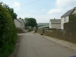
 Boode Road, Boode. | |
| Location | |
| Grid reference: | SS496378 |
| Location: | 51°7’12"N, 4°8’58"W |
| Data | |
| Postcode: | EX33 |
| Local Government | |
Boode is a small hamlet in northern Devon, just north-east of Braunton (which is north-west of Barnstaple). A large dairy farm is situated at Boode.
Outside links
| ("Wikimedia Commons" has material about Boode) |