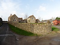
Alston Sutton
From Wikishire
Revision as of 22:25, 11 April 2022 by RB (Talk | contribs) (Created page with "{{Infobox town |name=Alston Sutton |county=Somerset |picture=Farmyard machinery graveyard^ Alston Sutton - geograph.org.uk - 113143.jpg |picture caption= |os grid ref=ST415514...")
| Alston Sutton | |
| Somerset | |
|---|---|
| 250px | |
| Location | |
| Grid reference: | ST415514 |
| Location: | 51°15’33"N, 2°50’23"W |
| Data | |
| Postcode: | BS26 |
| Local Government | |
Alston Sutton is a farm hamlet in northern Somerset, on the little spur hill on which Wedmore stands surrounded by the Northern Somerset Levels. The hamlet is about half a mile south of Weare, and two miles north of Wedmore.
