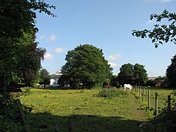
Adbolton
From Wikishire
Revision as of 20:12, 12 August 2021 by RB (Talk | contribs) (Created page with "{{Infobox town |name=Adbolton |county=Nottinghamshire |picture=Adbolton on a May morning - geograph.org.uk - 2430778.jpg |picture caption=Adbolton |os grid ref= SK596378 |lati...")
| Adbolton | |
| Nottinghamshire | |
|---|---|
 Adbolton | |
| Location | |
| Grid reference: | SK596378 |
| Location: | 52°56’3"N, 1°6’42"W |
| Data | |
| Post town: | Nottingham |
| Postcode: | NG4 |
| Local Government | |
| Council: | Rushcliffe |
Adbolton is a hamlet in Nottinghamshire on the south bank of the River Trent, just east at the edge of the outmost swelling of West Bridgford and one mile west of Holme Pierrepont. Nottingham City Centre is a mole and a half to the north-west, across the river.
Adbolton is listed in the Domesday Book of 1086.[1]
References
- ↑ Adbolton in the Domesday Book