Saunders Island, Falkland Islands
- Not to be confused with Saunders Island, South Sandwich Islands
| Saunders Island | |
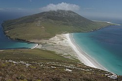
 "The Neck" on Saunders Island | |
|---|---|
| Main settlement: | Saunders Island Settlement |
| Location | |
| Location: | 51°20’34"S, 60°10’50"W |
| Area: | 51 square miles |
| Highest point: | Mount Richards, 1,499 feet |
| Data | |
Saunders Island is the fourth largest of the Falkland Islands, lying northwest of West Falkland. The island is run as a sheep farm. It has an important place in the history of the islands as the site of the first British settlement.
The island has an area of 51 square miles and has a coastline 66 miles long.[1] It is about 13 miles from east to west and almost that distance from northeast to southwest.
The island consists of three peninsulas linked by narrow necks, and it has three large upland areas. The highest point, Mount Richards, is 1,499 feet high.[2]
History
Port Egmont on the island was the site of the first British settlement, established in 1765.
Unaware of the French presence at Port Louis, in January 1765, British captain John Byron explored and claimed Saunders Island, at the western end of the Falkland Islands, where he named the harbour of Port Egmont, and sailed near other islands, which he also claimed for King George III. A British settlement was built at Port Egmont in 1766. Also in 1766, Spain acquired the French colony, assuming effective control in 1767.
During the Falkland Crisis of 1770, five Spanish frigates entered the small British force had to surrender. This edged Britain and Spain closer to war. In 1771, Spain agreed to abandon Port Egmont to the British. In 1776, for economic reasons, the British abandoned Port Egmont. At that time, they placed a plaque at the site proclaiming their sovereignty over the Falklands. The island's present settlement, appropriately called Saunders Island Settlement, lies on the east coast and has an airstrip.
There is one listed building here, known as the Stone House.[3]
Wildlife and Conservation

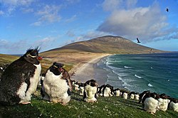
Wildlife on the island includes rockhopper, gentoo, Magellanic and king penguin, black-browed albatross and many other birds. As far as the Magellanic penguin, Saunders Island is near the southernmost limit of this bird's range,[4] whereas the Gentoo ranges much further south into Antarctica. There is also a small breeding area for Elephant Seals at Elephant Point. Royal Air Force Ornithological Society's members did a complete coastal survey in 1995 [5]
Conservation issues include the danger of fire, some erosion prone areas near the coast, overgrazing and the presence of cats, mice, rats and some rabbits. Clearance of these introduced species is unlikely in the near future because of the size of the island and the varied geography. Spear thistles, which were accidentally introduced to the island are becoming more prevalent. Volunteers helped to destroy some of them in the (southern) autumn of 2003 and there are hopes that the plant can be eradicated from Saunders Island in a few years [6]
Outside links
- Pictures from Saunders Island
- [http://www.quantumtiger.org/search.htm?key=saunders+island Wildlife images from Saunders Island
References
- ↑ Eurosion: D2.1.1 Inventory Report, page 122.
- ↑ PART II: Falkland Islands Important Bird Areas - Saunders Island
- ↑ Falkland Islands Information Web Portal. 2006
- ↑ C. Michael Hogan. 2008
- ↑ http://www.falklandsconservation.com/wildlife/birds/IBAs/iba_saunders.pdf
- ↑ http://www.falklandsconservation.com/wildlife/birds/IBAs/iba_saunders.pdf
- Cambridge Encyclopedia of Latin America and the Caribbean. 1985. ed. Simon Collier, Cambridge University Press, London
- Falkland Islands Information Web Portal. 2006. Buildings and Structures in the Falkland Islands designated as being of Architectural or Historic Interest
- C Michael Hogan. 2008. Magellanic Penguin, GlobalTwitcher.com, ed. N. Stromberg</ref>
- Stonehouse, B (ed.) Encyclopedia of Antarctica and the Southern Oceans (2002, ISBN 0-471-98665-8)