Stubbles
| Stubbles | |
| Berkshire | |
|---|---|
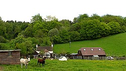
 Farm between Stubbles and Hanging Close Row | |
| Location | |
| Grid reference: | SU570765 |
| Location: | 51°29’7"N, 1°10’49"W |
| Data | |
| Postcode: | RG8 |
| Local Government | |
| Council: | West Berkshire |
Stubbles is a hamlet in Berkshire found amongst the forested hills of the Berkshire Downs on a minor lane southeast of Ashampstead.
Upper Basildon lies to the east, with Quick's Green between them. The woods of Ashampstead Common lie to the south.

This Berkshire article is a stub: help to improve Wikishire by building it up.