Bleadney
| Bleadney | |
| Somerset | |
|---|---|

| |
| Location | |
| Grid reference: | ST483453 |
| Location: | 51°12’18"N, 2°44’27"W |
| Data | |
| Postcode: | BA5 |
| Local Government | |
| Council: | Somerset |
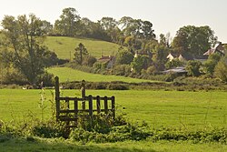
Bleadney is a hamlet in Somerset, strung along a ridge amidst the Somerset Levels that stretches from Wells to Wedmore, carrying the B3039. It adjoins Henton to the east on the ridge.
Outside links
| ("Wikimedia Commons" has material about Bleadney) |
