Henton, Somerset
| Henton | |
| Somerset | |
|---|---|

| |
| Location | |
| Grid reference: | ST493454 |
| Location: | 51°12’21"N, 2°43’35"W |
| Data | |
| Postcode: | BA5 |
| Local Government | |
Henton is a long, narrow hamlet in Somerset, on the little, narrow hill ridge extending west from Wells in the midst of the Somerset Levels carrying the road from Wells to Wedmore. Henton is found a mile and a half west of Wookey and the same distance from Theale. It has become contiguous with Bleadney, another hamlet clinging to the narrow ridgetop.
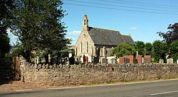
The village has a little church, Christ Church.
Outside links
| ("Wikimedia Commons" has material about Henton, Somerset) |

