Cudworth, Somerset
| Cudworth | |
| Somerset | |
|---|---|
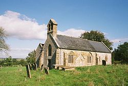
 St Michael, Cudworth | |
| Location | |
| Grid reference: | ST375105 |
| Location: | 50°53’26"N, 2°53’24"W |
| Data | |
| Population: | 69 (2011) |
| Post town: | Ilminster |
| Postcode: | TA19 |
| Dialling code: | 01460 |
| Local Government | |
| Council: | South Somerset |
| Parliamentary constituency: |
Yeovil |
Cudworth is a village in Somerset (in the South Petherton Hundred), five miles north-east of Chard. The village had a population of 69 at the 2011 census.
History
The manor was held, around 1187, by Alan de Furneaux who gave the church and thirty acres of land to Wells Cathedral to found the Cudworth prebend. The Speke family had the lordship from 1431 to 1791 when it was bought by the Pouletts of Hinton St George.[1]
To the east of Knight House Farm are earthworks showing the site of houses, tracks and farming from a mediæval village.[2]
Parish church
The parish church, St Michael, has 12th-century origins, with the north doorway and one small window of that period remaining. The nave and chancel are from the 13th century.[3]
The Old Prebendal House was built as a vicarage in the 17th century.[4]
| ("Wikimedia Commons" has material about Cudworth, Somerset) |
References
- ↑ Bush, Robin (1994). Somerset: The Complete Guide. Dovecote Press. pp. 78. ISBN 1-874336-26-1. https://archive.org/details/somersetcomplete0000bush/page/78.
- ↑ National Heritage List 1016412: Mediæval settlement east of Knight House Farm (Scheduled ancient monument entry)
- ↑ National Heritage List 1366403: Church of St Michael (Grade II listing)
- ↑ National Heritage List 1177270: The Old Prebendal House (Grade II listing)
