Kingston Russell
| Kingston Russell | |
| Dorset | |
|---|---|

| |
| Location | |
| Grid reference: | SY576914 |
| Location: | 50°43’13"N, 2°35’39"W |
| Data | |
| Population: | 35 (2001) |
| Postcode: | DT2 |
| Local Government | |
| Council: | Dorset |
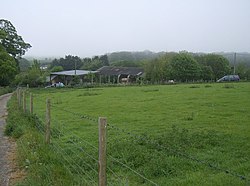
Kingston Russell is a hamlet in Dorset, sitting seven miles to the west of Dorchester, The 2001 census recoded a parish population of 35.
History
The name "Kingston" means 'King's stone', it was held by John Russel in 1212.[1]
See also
| ("Wikimedia Commons" has material about Kingston Russell) |
References
- ↑ "Kingston Russel Key to English Place-names". The University of Nottingham. http://kepn.nottingham.ac.uk/map/place/Dorset/Kingston%20Russel.
