Knapp, Somerset
| Knapp | |
| Somerset | |
|---|---|
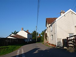
 Houses in Knapp | |
| Location | |
| Grid reference: | ST301251 |
| Location: | 51°1’16"N, 2°59’48"W |
| Data | |
| Postcode: | TA3 |
| Local Government | |
Knapp is a little village in Somerset, on a minor rise in the Somerset Levels a mile west of North Curry and east of Creech St Michael. The River Tone flows by the north of the village.
A hamlet, Lower Knapp, is attached at the east side of the village.