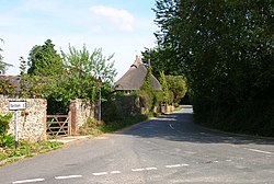
Crockerhill, Sussex
| Crockerhill | |
| Sussex | |
|---|---|
 Crockerhill | |
| Location | |
| Grid reference: | SU921070 |
| Location: | 50°51’21"N, -0°41’30"W |
| Data | |
| Postcode: | PO18 |
| Local Government | |
Crockerhill is a hamlet in the south-west of Sussex, beside the A27 trunk road that heads west to Chichester and on to the Hampshire cities. Its sits between Tangmere to the west and Fontwell to the east. Crockerhill has one public house, The Winterton Arms.
Outside links
| ("Wikimedia Commons" has material about Crockerhill, Sussex) |
