Latady Island
| Latady Island | |
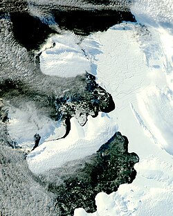
 Latady Island (centre) during the ice bridge collapse | |
|---|---|
| Location | |
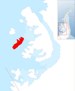
| Location: | 70°54’58"S, 75°9’58"W |
| Area: | 1,274 square miles |
| Data | |
| Population: | Uninhabited |
Latady Island is a low ice-covered island in the British Antarctic Territory, about 35 nautical miles long and more than 10 nautical miles wide, lying in the Bellingshausen Sea to the west of Alexander Island, 45 nautical miles south of Charcot Island.
An ice-covered feature in this approximate position was seen from the air and described by Sir Hubert Wilkins in 1929, but not recognized as an island or separately mapped. Latady Island was first photographed from the air by the Ronne Antarctic Research Expedition of 1947–1948, and mapped from these photos by D. Searle of the Falkland Islands Dependencies Survey in 1960.
The island was named by the UK Antarctic Place-Names Committee for William R. Latady, an aerial photographer and navigator on the Ronne expedition's flight.
References
- Gazetteer and Map of The British Antarctic Territory: Latady Island
