Merger Island
| Merger Island | |
| Location | |
| Location: | 70°16’59"S, 70°42’0"W |
| Data | |
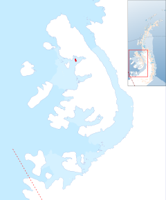
Merger Island is an island 3 nautical miles long at the entrance of Haydn Inlet, lying off the west coast of Alexander Island in the British Antarctic Territory. It is ice-covered, except for two small rock outcrops and it rises to 902 feet at its summit.
The island was mapped by D. Searle of the Falkland Islands Dependencies Survey in 1960, from aerial photographs taken by the Ronne Antarctic Research Expedition in 1947–48. The name given by the UK Antarctic Place-Names Committee is descriptive, the island descriptively, the island merging with the surrounding Wilkins Ice Shelf.
References
- Gazetteer and Map of The British Antarctic Territory: Merger Island
