Rownhams
| Rownhams | |
| Hampshire | |
|---|---|
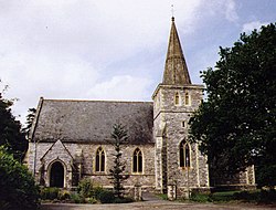
 St John the Evangelist, Rownhams | |
| Location | |
| Grid reference: | SU384170 |
| Location: | 50°56’51"N, 1°27’15"W |
| Data | |
| Post town: | Southampton |
| Postcode: | S016 |
| Dialling code: | 023 80 |
| Local Government | |
| Council: | Test Valley |
| Parliamentary constituency: |
Romsey and Southampton North |
Rownhams is a village in Hampshire, standing within the northern edge of the conurbation stretching out from Southampton, beside Nursling. The M27 motorway carves its path to the north of the village, and a motorway service station, Rownhams Services, is nearby.
The village consists of over 1200 homes. Rownhams house, a Georgian mansion, is now a business park and wedding venue,[1] The parish church is St John the Evangelist.[2] There is a community centre, a primary school,[3] two pre-schools and a hairdressing salon. The village is planned to grow in the next few years as several planning applications are either in the system or have been approved.
Outside links
| ("Wikimedia Commons" has material about Rownhams) |
- Nursling and Rownhams History Group Local History in Nursling and Rownhams, Hampshire
- Romsey Local History Society Local History in Romsey and its surrounding area
References
- ↑ "Rownhams House". https://www.rownhamshouse.com. Retrieved 25 January 2019.
- ↑ "St Boniface & St John's". https://twinspires.org.uk/index.html. Retrieved 25 January 2019.
- ↑ "Rownhams St. John's C of E Primary School". https://www.rownhams.hants.sch.uk. Retrieved 25 January 2019.
