Liss Forest
| Liss Forest | |
| Hampshire | |
|---|---|
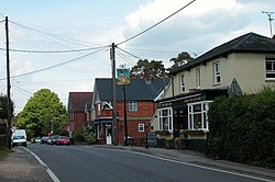
 The Temple pub, Liss Forest | |
| Location | |
| Grid reference: | SU785275 |
| Location: | 51°3’14"N, -0°53’10"W |
| Data | |
| Post town: | LISS |
| Postcode: | GU33 |
| Dialling code: | 01730 |
| Local Government | |
| Council: | East Hampshire |
| Parliamentary constituency: |
East Hampshire |
Liss Forest is a village immediatekly to the north the larger village of Liss, in the east of Hampshire. As its name suggests, Liss Forest is surrounded by woodland, Much of this open forest land is owned by the Ministry of Defence and is used for military training.
The village has one pub, The Temple.
At one time the village had its own railway station on the now closed Longmoor Military Railway.